Andersonville,
Civil War Village

Tribute to War Crimes Map
From Andersonville

(Part III of a three part serious on my trip to Andersonville, Part I here, Part II here)

After your stop at the Andersonville National Cemetery, there is one last place one feels compelled to see before departing the area. Across from the gate and the busy highway, stands the gate to the city of Andersonville. A quiet and infamous town, but home to something you won’t find anywhere else. It was here that the chief caretakers of the nefarious prison lived, most notable among them was the Commanding Officer Capt. Henry Wirz.


As you drive into the city, you can’t miss the one-of-a-kind item, I mentioned. It is a stone obelisk rising about 20 feet in the air planted smack dab in the middle of the road in the center of town. And this monument is erected in honor of Captain Wirz, the fabled Demon of Andersonville. Now there are Confederate Monuments scattered all throughout this state and country. And as a real part of our history, I don’t begrudge this fact, provided it is done respectfully and within context. But Captain Wirz was tried, convicted, and hanged for War Crimes. So this memorial is the only monument erected to honor a war criminal placed on American Soil. Some list Captain Wirz as the only man convicted of War Crimes during the Civil War, but there is also historical record of a Tennessee irregular combatant being executed, Champ Ferguson, though his status as a War Criminal is debatable. Another perplexing note, speaking to my feelings about visiting the POW museum, is that Wikipedia’s List of American War Criminals has only 10 entries: one from the 19th century, Henry Wirz; one from the 20th Century, William Calley, architect of the My Lai Massacre (1968); and the other eight entries are from the current century which stands at writing a mere 10 years old.


In addition to the monument, there are the offices of Captain Wirz on the corner. There’s a railroad crossing and a few railcars. There is a diorama exhibit of the prison, but as we arrived late in the day the whole place was closed. It looked pretty much like other small towns in Georgia, but the vacant nature and the area’s history gave it a decidedly eerie feel. Now I don’t buy into any paranormal activity whatsoever, but I can understand why the gullible and so inclined have repeated many Ghost Stories of Andersonville. On the positive side, there is a historical marker to the good Father Peter Whelan who ministered to the prisoners and prison keepers of Andersonville, serving God as if He was neither Blue nor Gray. If you are looking for a hero in this story, Father Whelan may be your best bet.

From Andersonville

Behind the row of buildings on the left side, there is an interesting little city park. A small creek runs through it and they have gathered a number of old wooden shacks to make it quite photogenic. One of the shacks is a jail with a prisoner inside it. There is a kind of cheesy replica mill complete with Christmas lights. But the most fascinating part of the park is a cage containing two beautiful peacocks (well one beautiful peacock and one less glamorous peahen). As they are native to India (and I believe they are of the blue Indian variety), I have never seen any peafowl outside of a zoo or habitat community. To find these striking creatures in the small town of Andersonville’s city park was a perfect, albeit completely out of place, cherry on the top of a grand excursion.


In summary, the prison recalls an awful time in our history. The POW Museum makes us consider our collective humanity. The Prison site makes us shudder at the prospect of how low man can sink. The Cemetery makes us reflect on those who carried our banner. And the city makes us question our views of the past. Our jaunt to Andersonville was something that moved me deeply. I would offer that the historical impact of this area is second only to the Martin Luther King Historic Sites and our Civil Rights Legacy. Now, I’m looking forward to a better meaning of the word, “Civil.”

Rocktown

I Wanna Rock All Night… Map
From Rocktown

I have this list of places I want to see in and around Georgia. People email me and I talk to folks (and all suggestions are very welcome). So there’s this one place a little over two hours Northwest of Atlanta, that I’ve heard a lot about and have always been meaning to go, but it has been difficult to conscript a volunteer to sojourn along with me. Because when asked what the draw is, I can only answer, “Rocks.” But as luck would have it this past July, after another voyage nearby sort of petered out due to warm weather and lack of water at the falls, I was able to get my companions to visit these “Rocks” as a fallback option. And the day was salvaged by a truly amazing visit to a place known only as Rocktown, near LaFayette, Georgia.


Rocktown is at the culmination of one of Several Hiking Trails on Pigeon Mountain in the Cumberland Plateau region of the state. It is probably the easiest of the bunch consisting of a very flat and very well maintained one mile walk from the parking area, even though it is at the summit of the mountain. At the end of the path, there are myriad rocks covering easily 100 acres of land. Some of the rocks are as tall as two or three story buildings. The greys and browns of the sandstone mix with the reds of the iron ore to create some visually stunning patterns. Some have odd shapes that remind one of other things like finding patterns in clouds on a lazy summer’s day.


So our easy one mile hike turned into a three hour festival of rock climbing. Now this is a true mecca for the avid rock climber and we saw a few younger folks decked out with pads and rope and the like. We had no equipment, but for a great many of the rocks none were needed. After hauling yourself up a 30 foot rock, you would be rewarded with a view of more rocks. I’ve have never been on a hike when the end of day aches focused so much on the arms and shoulders. But the pain was well worth the sense of accomplishment.


We watched a few children rush up and down the boulders, screaming with glee like it was the greatest thing ever. And some of the rocks created caves and overhangs that served as well needed shade from the hot Georgia Sun. The only caveat would be the wildlife in the area: I heard reports of bobcats but none were seen by us; our principle nemesis was the nuisance of ants when we tried to sit atop a boulder for our lunch. But this was a mild problem in comparison to the enjoyment we were able to get.


So Rocktown might be a little far away, but well worth the trip. The remoteness help keep these rocks relatively free of graffiti and vandalism. If you are looking for fun and exercise in the Northwest corner of the state, this is a great place to spend the day. It is quite understandable what all the fuss is about.


Trail Essentials
Approximate Time: 3 hours (path 1 hour-leaving plenty of time to play on the rocks)
Approximate Distance: 2 miles round trip
Features: Rocks, Vista Views

Overall Rating: A

Scenic Quality:A
Athleticism: A+
Solitude: A-
Value: A
Parking: Free
Hours of Operation: Daylight hours
Facilities: None
Maps: here (the little pink path near the center), not really needed
County: Walker

Hurricane Shoals Park

Roaring Waters & Historic Buildings map
From Hurricane Shoals Park
The ideal place for me to visit has a number of different attributes. Two of which are a location within a reasonable distance of my home and something interesting to see. If it is free, then all the better. I was doing a little research on another place when I happened across a location in Jackson County, two counties up from Gwinnett and about an hour and fifteen minutes Northeast of Atlanta, that meets all these criteria. The place is the county’s one and only park, known as Hurricane Shoals Park in Maysville, Georgia.

Now, I work off Hurricane Shoals Road in Lawrenceville and I always wondered how the word Hurricane ever got associated with someplace this far inland in Georgia. And my visit to Hurricane Shoals did answer that. It is a derivation of the Indian Word Yamtrahoochee meaning something like “tumbling or roaring waters.” Over the years, these roaring waters were updated and Anglicized as the more poetic Hurricane Shoals, without any actual Hurricane. Interestingly enough, 90% of the time you would visit you get a peaceful and serene tumbling of water in a most bucolic setting along the North Oconee River. But I tend to chase water after heavy rain, so I got to see first hand what the Indians meant by the name (Video at bottom of post).

The water is the first draw to the park. And there are the ever present picnic spots and playgrounds. They also have one of the nicest Miniature Golf Courses I’ve seen in a public place and a disc golf course also. But the other big attraction is a Pioneer Village, that is one of the nicer collections I have seen in the area. There’s about 15 old buildings, many of which you can walk inside. They include a church, a courthouse, several log cabins, a corn crib, a smokehouse, an outhouse. I would put their collection right up there against most all the villages of this kind I have seen. And the true boon is the general accessibility; we were able to enter at least a half a dozen.

If you want to construct your visit as if it were a hike, it was very reminiscent of New Echota, though the trails are not even laid. If you park by the shoals, you walk up the road, across the covered bridge (did I mention the Covered Bridge? I’ll discuss that at a separate entry), and a short ways up on the left there’s the pioneer village. You make a circle around the buildings then head back to the covered bridge cross and walk across the shoals on a thin bridge. On the other side is the minigolf course and the mill. After heading along the water, where the stone runway is evident, you can recross the bridge and explore the other side of the water’s edge. Walking in this manner will put you above 1 mile but shy of 1.5 miles and you get your exercise. Besides the furious water, there were ducks and other wildlife and plenty of places to sit back and get your fill of nature.

So if you’re a county and you are only going to do one park, my advice is do it big. The folks in Jackson County knew this and built Hurricane Shoals Park for us to enjoy. My understanding is that what I saw was only a small fraction of what was to be seen (I didn’t even make it to the Mill as I had an appointment to make and dawdled a long time marveling at the rushing water). I would like the folks who built this fine park to take this post as my sincere thank you for giving us Georgians something so nice. I promise I will be back.

Trail Essentials
Approximate Time: 1.5 hours
Approximate Distance: 1.5 miles
Features: Ruins, Tumbling Waters, Covered Bridge, Pioneer houses

Overall Rating:

Scenic Quality: A+
Athleticism: C
Solitude: A-
Value: A
Parking: Free
Hours of Operation: April thru October 9am-9pm (March & November 9-6 weekends only
Facilities: throughout the park
Maps: None
County: Jackson

Blue Ridge Scenic Railway

He’s goin’ back to a simpler place and time…Map
From Blue Ridge Scenic Railway


There’s something in our collective unconscious that thinks trains are romantic. As a person who has actually travelled by train, I understand this in part, but I know it’s mostly being stuck in a cramped box for hours. But still even I tend to romanticize the railroads. Now there are some great things about it, the slow passage of time, views of the American countryside, and the lullaby of rail on steel. A great way to get the best of the rail without the worst of the rail resides about an hour and 45 minutes north of us in Blue Ridge, Georgia at the appropriately named Blue Ridge Scenic Railway.


Leaving the city of Blue Ridge every day except most Tuesdays and Wednesdays (Schedule) is a seven or eight car train that traverses the Murphy Connector between Blue Ridge and McCaysville, Tennessee. The trip is 13 miles one way with an hour break in McCaysville. There are normally two or three open air cars and two or three closed cars so you can escape or enjoy the weather. The cars themselves are restored historic railcars from times past and places as far away as New York City. The trip takes about four hours in total. There are restrooms and a snack car on the train if either should become necessary.


The Summer cost is a little on the high side at $32 (fares) with discounted pricing for Seniors and children 12 and under. But compared to buses, trains, and planes, it’s not that out of line. And what you’re paying for is the experience. You get to rush behind peoples homes and along the serene Toccoa River. Along the way, people run out to wave at the passing trains, you get to see an ancient Indian fish trap, and the occasional encounter with wildlife. This must be a fascinating way to see the fall colors turn, if that’s your sort of thing.


The only negative about the trip is the stop in McCaysville. Sure it’s a cute little country town, and it has this charming blue stripe running through it separating Georgia from Tennessee and the town of McCaysville from Copperhill. But If you’re thinking of dinner, the food is a bit regrettable. We ate at the Nifty Fifties Diner, which had a beautiful view of the river and some nice bluegrass music, but the food was reminiscent of the kind of stuff you’d get at your average bowling alley, but kids may enjoy it. Based on my discussions with fellow travellers, I think your best bets would be the BBQ joint across from the train station (not next to it) or the Mexican eatery.


I write this because I recently received an email about discounts to the rail road for weekday excursions and for reserving the Christmas ride with Santa Claus, if you book before August 31st. The code for the Santa excursion is SUMSANTA10 and the weekday trips is SUM10WEEKDAY, both being good for 10% off (2010 codes). Even at full price, the Blue Ridge Scenic Railway is an enjoyable was to relive the glory days of American Trains without the commitment or hassle of spending too much time stuck in a metal box.

Tribble Mill Park

No Trouble with Tribble Mill Park Map
From Tribble Mill Park

There was a day about in the not too distant past when I was the only one of my friends who had a bicycle. Recently that has changed. In looking for something to do, my bicycling friends asked me where did I usually go when I went biking by myself. And I told them about Tribble Mill Park and off we went. I kind of forgot about this place because I had already been there a dozen or so times, but because of their enjoyment I thought it high time I shared it with my readers.


The park sits on about 700 Acres of land about 35 miles from Atlanta and less than 15 miles from my home. The land is on the former site of Tribble Mill, one of Georgia’s defunct mills, and I hear that some ruins are still present there, but I have yet to find them (I think they may be near the Southwestern Corner of Chandler Lake). The main features of the park are two lakes, Ozona Lake and Chandler Lake and the trails, for the most part, go around them.


The main trail is a paved 3.4 Mile loop which basically encircles Lake Ozona (Trail Maps). It does cross over the lake at one place, where you share the road with cars within the park. There is another ironwork bridge on the East side of the Lake. There are additional unpaved paths that I have seen estimated at about 12 miles. The most notable of which is the path around Chandler Lake, which makes for an easy hike or a mildly challenging bike path.


The one negative thing I have heard is that the bike trails are not clearly marked. I think this is part of the fun of it. You kind of explore without really knowing your final destination. But you really are never that far from a navigable landmark, whether it be the shore of the lake, or the Paved Path, or Tribble Mill Parkway (the road cars use). So it is difficult to truly get lost.


The park is also well known for fishing and light boating. There’s ample playgrounds and picnic areas. Gwinnett Parks & Recreation is truly doing a fantastic job building up greenspaces for us to use and enjoy, with Tribble Mill Park being no exception. It’s a good place to take a walk and a great place for mixed use bicycling.


Trail Essentials
Approximate Time: 1-1 ½ hours (paved trail), 1 hour (Chandler Lake Trail)
Approximate Distance: 3.4 mi (paved trail), 2 mi (Chandler Lake Trail)
Trail Surface: Paved, Compact Soil
Features: Lakeside View, Two nice Bridges, Wildlife

Overall Rating: B

Scenic Quality: B+
Athleticism: B
Solitude: B-
Value: A
Parking: Free
Hours of Operation: Daylight hours
Facilities: Throughout the park
Maps: At Trailhead, here

Flying Machine at Gwinnett Briscoe Field

The Gwinett Briscoe Airport, Fun amid Controversy Map
From Flying Machine

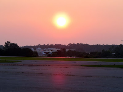
Ok, this one’s a little nepotistic because a good friend of mine runs the joint. But there used to be a time when I was younger when I would sit out on Frontage Road outside Orlando International Airport and watch airplanes take off and land as a nice way to pass the evening with a special friend. With the onset of terrorist watches, you can’t sit out on that road anymore without being moved along by police. However, you can still get the same experience (while it lasts), at the Flying Machine in Lawrenceville, Georgia.


Now, I wish I had more photos of the food and bar area, I thought I had enough from previous visits. Briscoe Field is a small airport, which may be getting bigger, but currently is capable of handling light aircraft and corporate jets. The volume of air traffic isn’t huge, as it is almost entirely private planes, and is affected for better and worse by the quality of the day’s weather. During my last day there, we saw about a dozen planes use the runway over a two and a half hour period on a Sunday Afternoon.


As for the food, you get solid pub food done at fair prices (Menu). The $100 burger costs $6 (the higher price due to the cost of flying your plane in to get one). They have a few beers on tap, all domestics, with a wallet friendly $2.75 price. And a couple of dozen more in the bottle (I drank Landshark for $3.99). It is a very nice place to have a drink and some food on the patio, with the planes creating a nice backdrop.


They are also well known for music, particularly country music. The proprietor, who uses the name, Hokey Sloan had some minor fame with a song called “I didn’t give her the car.” The day we were there he played a new tune called “Same Ol Same Ol” and the rumor is he’s spending some time in the recording studio. He also played a Conway Twitty number at our request. A number of country acts play through there and you can check their website for a schedule.


What you get is good pub food and drinks at reasonable prices, nice music, and the planes creating a wonderful backdrop for you and your friends. I’m surprised more kids aren’t there as the place is family friendly and the children we saw were enthralled by the speeding aircrafts. And if the recent brouhaha about privatizing the airport comes to fruition, you might not have that much more opportunity to chill at Gwinnett’s quaint little airstrip. So you better get while the getting’s good and enjoy while it lasts. You can tell him I sent you (Hokey knows me as Doug).


Restaurant Fundamentals
Address: 510 Briscoe Blvd, Lawrenceville GA 30045 ( Gwinnett County)
Phone: 770.962.2262
Website: www.theflyingmachine.com

Cultural Significance: B+
Food Quality: B
Healthiness: C (its pub food remember)
Price: A
Value: A+

Overall Rating: A-

Recommendations: Burgers and Beer, topped with Hummingbird Cake
Significance: A Deck literally right on an Airport Runway, Country Music

Poole's Mill Covered Bridge

WATER UNDER THE BRIDGE Map
From
It is pretty hot outside as it gets this hot every year. I often get slowed down by the heat. One only has a few choices. Stay Inside. Get out at dawn. Go outside to go inside. Or get wet. The last answer made me think of a place that marries a great swimming hole with one of my other fascinations: covered bridges. The place is Poole’s Mill Covered Bridge just under 1 hour North of Atlanta in Cumming, Georgia (Park website here ).

The covered bridge was built in 1901 in the town lattice style while Dr. D. L. Pool owned the land as an addition to a gristmill and sawmill he had on that property (The reason for the extra “e” in the current titling is a mystery). Its 95 feet long, 14.5 feet wide and spans the waters of Settendown Creek. The bridge did collapse in 1980 but it was refurbished and a wonderful park built around it. 
The most noticeable feature in the park is the number of folks playing in the waters of the cascades of Settendown Creek just a few dozen yards downstream. I’ve taken to wearing clothes that allow me to cool off if the opportunity presents itself, but I only went in up to my knees. There’s even an old tree swing allowing kids to dive into the slightly deeper waters nearer the bridge.

As for the hiking trails of the area, there’s about 1.1 miles of trails, which are pretty easy. There’s a fence downstream that you can get around in order to explore the stream further, if you like. We went this way rather than the main path away from the bridge which leads to Miller’s House (a private residence that was once the supervisor’s home for the mill). Along the way, and aside from the bridge, you get nice views of falling waters, good rock formations, and pastoral quiet river views. We also saw some ducks and the always fun to watch swimming dogs. There were people picnicking and getting some sun. I would categorize this more of a pleasant walk than a meaningful hike, but that doesn’t mean it wasn’t enjoyable. It actually means that it’s more kid and dog friendly.

So in my commitment to eventually see all of Georgia’s Covered Bridges, I give you Poole’s Mill Covered Bridge. A nice walk in the park and a good place to cool off not too far from home.


Trail Essentials
Approximate Time: 1 hour
Approximate Distance: 1.2 mi
Trail Surface: Compact Soil, Rocks
Features: Covered Bridge, Waterfalls, Riverside views

Overall Rating: B

Scenic Quality: A
Athleticism: C
Solitude: C
Value: A
Parking: Free
Hours of Operation: Closes at Dark and November thru Spring
Facilities: Yes
Maps: none, not really necessary
County: Forsythe

Howard Finster's Paradise Gardens

Jesus, Coca-Cola, Elvis, George Washington and More Map
“Pardise
From Howard Finster's Paradise Gardens


There’s a bunch of interesting things I’ve seen in and around this North Georgia patch of land called Atlanta, which I call home. And this website has chronicled a good number of them, 99 to be exact. With the 100th post looming on the horizon, I wanted to find the perfect place to fill this illustrious position. I agonized a bit over the subject, and was considering downplaying the whole concept. That was until I made I took a two block drive off Martha Berry Highway in Summerville (or Pennville) coming home this past 4th of July. There, just under two hours away from Atlanta, standing at the corner of Rene & Knox Streets, appropriately shining like a vision from God, was the perfect subject of my 100th post, the home of the late great folk artist Howard Finster, and his Paradise Gardens.

“The

Now, I had recently learned that the place was open to the public. Until about October of 2010, it was viewable by appointment only and the nature of my ramblings doesn’t make me especially good at meeting appointments, but presently it is open 12-4:30pm, each Saturday and Sunday. It is free to enter, but donations are accepted and greatly needed to help finance the restoration of the property. There is also a three room gallery with Art for sale, including prints which aid the preservation project.
“smaller

Beyond the Gallery lies the treasure of this visit, a truly fascinating world. Directly behind lies the two story chapel with its 8-sided cupola. The chapel is currently under renovation, and entry is not allowed to this place which was home to many free weddings and other celebrations. Behind the chapel, is the Finster home, the place where he lived and the birthplace of this beauty and craziness. The painting of George Washington on the front is said to be his first. Going back toward the gallery, there is a bridge and exterior structure, where the art is mostly crafted by Art Students who came to study with Howard. There is also a freestanding project done by Finster with Lehigh University. And then there’s a smaller chapel which you can enter, the old bike shop, the side Gardens. The Gardens looks something like a miniature golf course, if the course had no holes, clubs, or balls, and was designed by a lunatic visionary who had a fondness for decoration via any object he found with an emphasis on shiny scraps of glass and metal and a penchant for the Bible, Coca-Cola and Elvis.

“on

Overall, the place has a pervasive religious theme. The story goes that after many years as a preacher, bike repairman, and sundry other jobs, Rev. Finster caught a drop of paint on his thumb, held it to the sun, and it spoke to him, telling him to paint 5000 works of sacred art. He painted virtually non-stop from that point on, and depending on what you call a work, he amassed nearly 50000. The type of art is folk or outsider and the content is visionary and naïve, for those who understand art. They range from completely painted bicycles (this one’s at the High Museum, not here) to carved faces in concrete to simple bible verses or poems hand scrawled by the artist. A piece taken by itself might pass for graffiti, but taken as a whole mean something much greater. A polite call to Godliness from hands and brush of a true Southerner.
“bicycle

His popularity soared in the 80’s after a New Yorker bought a piece and brought it to the big city. The Gardens and Finster were the centerpiece of R.E.M’s first video, Radio Free Europe (watch here). Finster also created the award winning cover for the Talking Heads album, Little Creatures (see here). He also made an appearance on Johnny Carson’s Tonight Show (watch here), where he showed off a little country charm and his talent for song and banjo. Howard Finster passed away in 2001.
“Bike

So now there’s a need for preservation, and fortunately there seems to be an interest, but unfortunately not a cohesive one. The site is owned by Tommy Littlejohn, and he utilizes members of the Finster family to run the museum. There is support from David Leonardis, a Chicago Art Dealer and Patron, who is restoring the chapel. And there is movement by Chatooga County to purchase the place, which supposedly will help in getting donations and grants. But the last piece of the puzzle is, well, me and you, so I suggest the next time you are in the Cumberland Plateau, or if you want to see the works of one of the more important Georgia Artists first hand, you trek up there to show those with the power that this place is important to us too. And if you can help the cause financially, please do.


If you wish to donate to the restoration project you can visit the website for the email info or email them directly at revcoltom@juno.com