Outdoor Advertising works Map Tweet
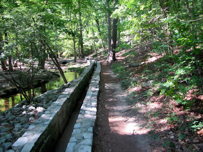
Tucked into the Northwestern Corner of our state is Lookout Mountain. On one side of Lookout Mountain, you have the pretty and pristine park known as Cloudland Canyon. On the other side of the Mountain, you have one of the most well-known tourist attractions in all of the Southeastern United States: a place that has attracted and is still attracting millions of visitors for better than 75 years. To be honest the entrance to this particular place is in Tennessee, just a stone’s throw outside of Chattanooga, and just over two hours away from Atlanta. Considering its reputation, its awesome photographical potential, and the fact it involves a waterfall, it amazes me that I waited until this year to visit Ruby Falls.

There are three tactics I use to beat the miserable heat during the dog days of summer. The most interesting method is to get underground, and it was exactly this motivation that brought my little group to Ruby Falls just a few weeks ago. I had read that the temperature at the Falls is a consistent 60 degrees. There is an Admission Fee of $17.95 ($9.95 children 12 and under) but discount Coupons are not hard to find. What you get is a 200-ft ride down in an elevator, a walk of about .4 mile to the falls, and then a nice view of a 145-ft underground waterfall. It is a very popular destination, so your time with the fall is limit to about 10 minutes to facilitate the number of visitors, but you do get to spend over an hour underground and out of the heat, in spite of the crowds.

This attraction was discovered in 1928 by Leo Lambert. Mr. Lambert had played and explored in the Lookout Mountain Cavern as a Youth, but the cave’s entrance had been closed out of necessity when the Southern Railroad Company built a tunnel nearby in 1905. Mr. Lambert received permission to drill from the top of the mountain into the earth to create and access point to the caverns. After drilling about 250 feet, still 100 feet from the intended cavern below, a gush of air came out. Mr. Lambert went down to investigate, crawling for 17 hours through a crevice 5 feet wide and only 18 inches high, he stumbled on the majestic Ruby Falls. He named the falls after his wife. Originally, the tour included the Lookout Mountain Cavern and the Ruby Falls Cavern, but has since been limited to simply the Falls tour.

The tour is a little strange. It is set up to wow its visitors the way you would expect a tourist attraction would, rather than the manner of a natural wonder. The place is filled with colored artificial light that in some ways enhances the experience, but at times makes you think that it would be pretty in its own right without it. At the end point, where the falls actually sits, it’s a full on roadside spectacular, complete with color-changing lights and majestic classic music to remind us that this is tremendous. In some ways, it creates a marvel to behold, but you still think the falls would be pretty neat on its own, regardless.

The primary criticism of the place is its touristyness. And they would be right. The waterfall is magnificent, but not so much more than others I’ve seen in the area. And the trappings create an aura of goofiness. To their credit, however, the place is well maintained and beautiful. The marketing doesn’t prepare you for just how beautiful the areas surrounding the falls are. I would even say the surrounding cavern, with its gorgeous terrains filled with stalagmites and stalactites, is better than the falls itself. And the fall is very nice on its own merits.

So if you are looking for a neat way to beat the heat, and don’t mind a medium length drive and a mid-range admission fee, Ruby Falls may be the place for you. I would actually go so far as to say, considering the omnipresent nature of the advertising for this place along the Southeastern highways and byways, it is something everyone in the area ought to see at least once in their life.

 |
| From Ruby Falls |
Tucked into the Northwestern Corner of our state is Lookout Mountain. On one side of Lookout Mountain, you have the pretty and pristine park known as Cloudland Canyon. On the other side of the Mountain, you have one of the most well-known tourist attractions in all of the Southeastern United States: a place that has attracted and is still attracting millions of visitors for better than 75 years. To be honest the entrance to this particular place is in Tennessee, just a stone’s throw outside of Chattanooga, and just over two hours away from Atlanta. Considering its reputation, its awesome photographical potential, and the fact it involves a waterfall, it amazes me that I waited until this year to visit Ruby Falls.
There are three tactics I use to beat the miserable heat during the dog days of summer. The most interesting method is to get underground, and it was exactly this motivation that brought my little group to Ruby Falls just a few weeks ago. I had read that the temperature at the Falls is a consistent 60 degrees. There is an Admission Fee of $17.95 ($9.95 children 12 and under) but discount Coupons are not hard to find. What you get is a 200-ft ride down in an elevator, a walk of about .4 mile to the falls, and then a nice view of a 145-ft underground waterfall. It is a very popular destination, so your time with the fall is limit to about 10 minutes to facilitate the number of visitors, but you do get to spend over an hour underground and out of the heat, in spite of the crowds.
This attraction was discovered in 1928 by Leo Lambert. Mr. Lambert had played and explored in the Lookout Mountain Cavern as a Youth, but the cave’s entrance had been closed out of necessity when the Southern Railroad Company built a tunnel nearby in 1905. Mr. Lambert received permission to drill from the top of the mountain into the earth to create and access point to the caverns. After drilling about 250 feet, still 100 feet from the intended cavern below, a gush of air came out. Mr. Lambert went down to investigate, crawling for 17 hours through a crevice 5 feet wide and only 18 inches high, he stumbled on the majestic Ruby Falls. He named the falls after his wife. Originally, the tour included the Lookout Mountain Cavern and the Ruby Falls Cavern, but has since been limited to simply the Falls tour.
The tour is a little strange. It is set up to wow its visitors the way you would expect a tourist attraction would, rather than the manner of a natural wonder. The place is filled with colored artificial light that in some ways enhances the experience, but at times makes you think that it would be pretty in its own right without it. At the end point, where the falls actually sits, it’s a full on roadside spectacular, complete with color-changing lights and majestic classic music to remind us that this is tremendous. In some ways, it creates a marvel to behold, but you still think the falls would be pretty neat on its own, regardless.
The primary criticism of the place is its touristyness. And they would be right. The waterfall is magnificent, but not so much more than others I’ve seen in the area. And the trappings create an aura of goofiness. To their credit, however, the place is well maintained and beautiful. The marketing doesn’t prepare you for just how beautiful the areas surrounding the falls are. I would even say the surrounding cavern, with its gorgeous terrains filled with stalagmites and stalactites, is better than the falls itself. And the fall is very nice on its own merits.
So if you are looking for a neat way to beat the heat, and don’t mind a medium length drive and a mid-range admission fee, Ruby Falls may be the place for you. I would actually go so far as to say, considering the omnipresent nature of the advertising for this place along the Southeastern highways and byways, it is something everyone in the area ought to see at least once in their life.