 |
| From WATSON MILL COVERED BRIDGE |
Earlier this year, I traveled to see the State’s Longest Covered Bridge, which sits as the centerpiece for a very nice 1000 acre state park situated at about 2 hours West and North of Atlanta (about 45 minutes West of Athens) near Comer, Georgia. The park bears the name of the Bridge and is called Watson Mill Covered Bridge State Park.

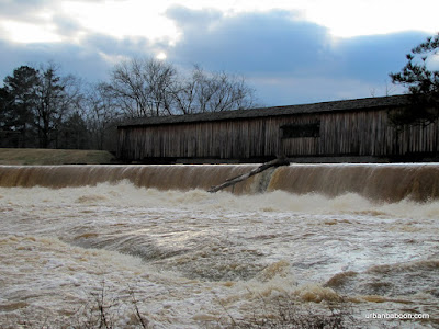
Now we came for the Bridge, a magnificent structure spanning 236 feet across the Broad River. It was built in 1885 by renowned bridge builder W.W. King in the town lattice style (A little History here ). It was built to replace an earlier bridge which washed out during one of the “freshets,” or flash flooding. I have read that the bridge is not in use, but you can drive across it and the road you are on will take you back toward Athens, so I think that information is incorrect.

On the day we went, in February of 2010, we experienced one of these freshets. The water was raging under the bridge and over the dam about 15 feet away. The banks of the broad river widened greatly covering the rocks and the land trees were growing from over a much greater span than the long bridge. It’s my understanding that the area is very popular for playing on the rocks and swimming, but there would be none of that this day.

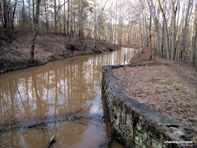
To our surprise, we found two very nice hiking trails on the both sides of the river. Both gave exceptional views of the river and bridge, but the North side was more interesting. Aside from a couple of well placed viewing platforms, they have some nice ruins of the old powerhouse. You get to walk a short two mile loop along the stream and back along the raceway (or vice versa). The South side loop runs about 2.5 miles beginning on the shores of the Broad river but then circling into the woods in what is billed as a nature trail, which could also be a fairly simple bike path.

Some of the covered bridges I have visited in the past, were simply little stop bys on the way to or back from another destination. The Watson Mill Bridge and surrounding state park can stand as a destination in itself: A nice 4.5 mile walk; a pretty river and historic bridge, and the possibility of a quick dip in the river along the rocks

Trail Essentials
Approximate Time: 2-2.5 hours
Approximate Distance: 4.5 miles
Trail Surface: Compact Soil, Rocks, some wooden stairs
Features: Riverside View, historic Bridge, Ruins
Overall Rating:
Scenic Quality: A
Athleticism: B
Solitude: B
Value: A
Parking: $5 (standard state park fees-2010)
Hours of Operation: Daylight hours
Facilities: At the welcome center
Maps: North side (not needed), South Side (Blazed)
County: Madison County
No comments:
Post a Comment