THE PRETTIEST PLACE IN ATLANTA...mapIn an attempt to experience life more fully, or as Thoreau put it, Live Life More Deliberately, I, much like Thoreau to Walden, went to the woods.
The woods might seem hard to find in an urban megalopolis like
Atlanta, but seek and you shall find.
My inspiration went to experiment on himself with simple living—one hundred and fifty years later, I simply wanted moments of clarity.
My experiments will be shorter and more to the point.
Like spending life at Walden with ADD and a Blackberry.
My two years, two months and two days can only be taken a couple of hours at a time.
My schedule won’t allow it.
I never set out to be perfect at living, but rather it is my attempt to be better at it.
Modern terminology simply calls it hiking.
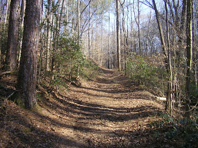
I found a place inside Atlanta, though the hike takes you just outside of the city, but clearly keeps you inside the perimeter. It has everything a person would want in a hike: Proximity, Physical Challenge, and Beautiful Surroundings. A quick jaunt down the Palisades East Trail.
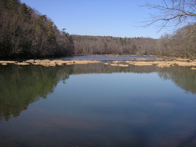
The trail begins along Long Island Creek, but the real payout is the moments along the Chattahoochee River. I won’t go into the ins and outs of the trail except that it is clearly marked and pretty easy to follow. It is basically a big loop with a couple of in and outs. The path is a little difficult primarily because of the steep climbs up and down to river level and the healthy distance pushing five miles.
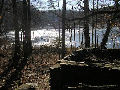
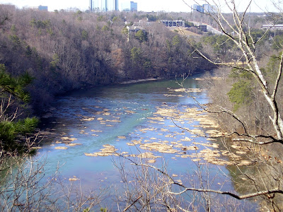
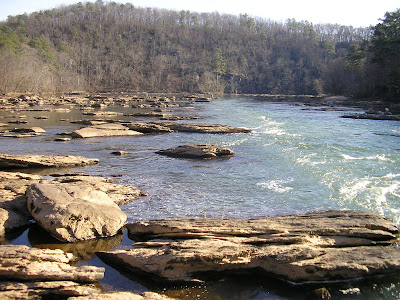
Once you get to the water, the scenery gets more dynamic. The word Palisades means fence-like structure, as in what surrounded a Castle in medieval times. This is an unnavigable portion of the Chattahoochee River for all but the smallest vessels. You might see kayakers or tubers, but no ships of any size. A tremendous series of rocks blockades the path like a fence. What’s great about this is that you can walk right out onto the water, get your feet wet if you water, and take in a 360 degree view of the mighty river. You then hike up a steep incline to a picturesque overlook for a tremendous long distance view of the River, complete with highways and civilization in the distance. At another spot, there are ruins of a simple cabin, built at a bend in the river, that is still as beautiful today as it must have 150 or 1000 years ago. If you are into plants and animals, there are some majestic blue heron living in the area (I saw two on my trip), and near the end of the trek, there is an immense bamboo forest.
The only drawbacks of the journey are due to the population in the area. Some people don’t respect the natural surroundings and litter. And, because of the proximity to the city, the walk can be quite populated at times. Still, having something this precious so close to where we live, encourages me and brings me happiness.
Trail Essentials
Approximate Time: 3 hours
Approximate Distance: 5 miles
Trail Surface: Compact Soil, Rocks
Features: Cascades, Ruins, River Views, Riverside Walk
Overall Rating: A-
Scenic Quality: A
Athleticism: B+
Solitude: C
Value: A
Parking: $3 (Jan 2007)
Hours of Operation: Open Year Round, Sunlight Hours
Facilities: None
Maps: Posted at Trailhead and through the Pathway
County: Fulton
Directions: Exit 16, I-285, South on Riverside. Turn right on Mount Vernon, then left on Northside Drive. Right on Indian Trail and enter the park.
Thanks a lot, Doug. Our little group of friends had a wonderful time with our warm up hike of the year due to your convincing recommendations!
ReplyDeleteVisited today...gorgeous trail...excellent recommendation.
ReplyDelete