 |
| From Kennesaw Moun... |
I’ve put this one off for way to long. And for that I apologize. It is truly one of the finest hikes in Area. When I first thought about classifying the hikes I have taken, I first formulated a more objective criteria, trying to give each hike a numeric value based on select criteria: Physical Challenge, Historical Significance, Natural Wonder, Cost, Solitude, & Proximity. And every time I ran the numbers this particular hike came up number 1. The catch to me was subjectively I thought a couple of hikes were better than it. (Now realize, only a couple of hikes are better than it, primarily due to the magnitude of the Natural Wonder the other hikes bring with it, remember I like to photograph cool stuff).
But this one has got all of those things with some extra to burn. I actually recommend that you take two days on this path. One for the front half and one for the back half (there are actually 18 miles of trails here).
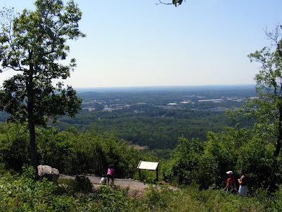
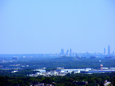
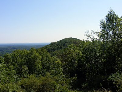
So who is this technical #1 in my book. I give you the majestic trail system at Kennesaw Mountain National Battlefield Park [Complete Park Map, Trail Map]. It’s a short drive out of town to Marietta. There’s no parking fee, so go as often as you like. The hike from the welcome center to the viewing platform is a little more than a mile with an elevation gain of around 700 feet. The view from the top of the mountain gives excellent panoramic views of the area, including nice views of Atlanta and the King and Queen Buildings in Sandy Springs. It’s a little better in the winter when the leaves are gone from the trees (I‘ve spent the past two Christmas days on this mountain--it is open), but there’s two or three good viewing places regardless of time of year. The only drawback to the trail is that the first section (from the Center to the main viewing platform) can be a little crowded, however if you continue past the platform, tranquility is normally yours.
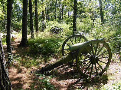
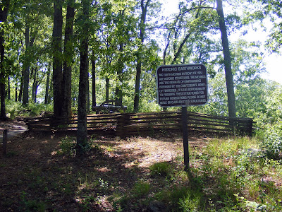
And the Historical Significance speaks for itself. You can learn a bit about what happened at the Battle of Kennesaw Mountain in the Welcome Center, but I suggest you do a little advanced reading beforehand so that you can appreciate the battleground and so you can relay and explain this to you traveling companions, especially if they are kids.
Since books have literally been written on the subject, I won’t go into too much detail, but suffice it to say that this battle was the last holdout before Sherman could get to Atlanta. Johnston and Sherman had been doing this strange tactical “dance” all through Georgia. Johnston would find a superior tactical position, Sherman would flank him. And before being surrounded Johnston would retreat to another superior tactical position. At Kennesaw Mountain this would end, primarily because the high ground was too good and its proximity to the rail line and Atlanta too close: this was where the bloody battle would commence. The battle lasted 13 days; 163,000 Americans fought; 67,000 were captured, killed or wounded; and an estimated 4,000 bodies laid dead on the battlefield. Here’s a few sites for further reading: ngeorgia.com, wikipedia, New Georgia Encyclopedia .
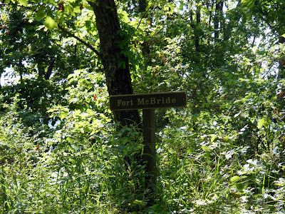
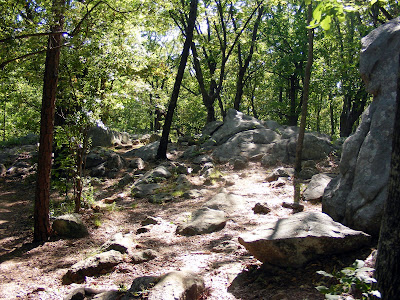
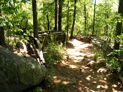
The hike starts up Kennesaw Mountain, then down, then up the smaller Little Kennesaw Mountain, then down, then up the much smaller Pigeon Hill, and then down. At that point you will see Burnt Hickory Road, which must be crossed. I normally turn around at this point and take the trail that skirt the mountain back (a nice level trail for your tired legs). However, you can park here on your second visit to continue up Cheatham Hill, past the monuments, and ending at Peter Kolb‘s Farm . If you can do all 16 miles in one day, I commend your tenacity and ability to get up early in the morning. (All the pictures in the post are from the first half by the way, I will deal with the second half separately).
In closing, this is a terrific hike that I (and I am sure most of you) have overlooked for too long. It’s free, nearby, a physical challenge, and in honor of one of the great historical events of our area. This isn’t a should do, it’s a must do.
Trail Essentials
Approximate Time: 7-9 hrs (full), 3.5-5.5 hrs(1st half), 3.5-4.5 (2nd half)
Approximate Distance: 16 miles (full), 10 miles (1st half), 8 miles (2nd half)
Trail Surface: Compact Soil, Rocks, some live street crossings.
Features: Civil War battle sites, Monuments, Mountaintop views
Overall Rating: A+
Scenic Quality: A
Athleticism: A+
Solitude: B+
Value: A+
Parking: Free
Hours of Operation: Trails open year round daylight hours, battlefield grounds and visitor center closed Christmas, Thanksgiving, and Easter.
Facilities: In the visitor center
Maps: Visitor Center, Some Signage, online here
County: Cobb County
No comments:
Post a Comment