 |
| From Skull Shoals |
The idea of a Ghost Town really has nothing to do with ghosts or the undead roaming the countryside. It really just means that the town has been completely abandoned by its inhabitants. But when the deceased borough has a terrifying name like Scull Shoals Village, it still conjures up those erroneous thoughts.
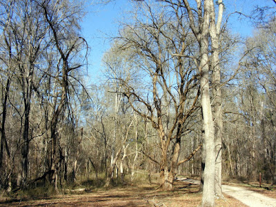
The fearful thoughts are aided by the fact that you have to drive pretty deep within the Oconee National Forest, at least for four miles on a dirt road called Forest Road 1234 also called Skull Shoals Road. [if you use the map above, you need to keep left for an additional half mile after Google’s map ends, to the parking place (no charge Feb 2008) you can see on the map as a bit of a brown blur]. We went in February and the dead trees added to the creepiness. But don’t be alarmed, we saw nothing extraordinary, unless you count several boaters cruising the Oconee, or the occasional fellow traveler like myself.
The name Skull Shoals (or alternatively spelled Scull Shoals) has been used for the area since the 1830’s. The city was named after the Skull Shoals Manufacturing Company, or maybe the company was named for the land, I’m not sure. The stories of the name are varied. Some say that they found a bunch of skulls in the area, which could be true. Some say it’s a variant on the name of a seafaring vessel, which seeing the land is on the Oconee could be reasonable. But whatever the story, that is the name that it has, for good or for evil.
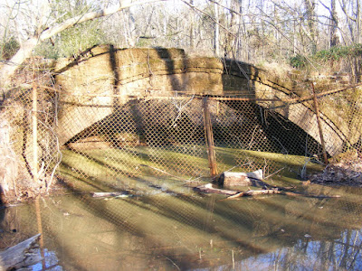
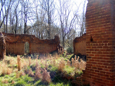
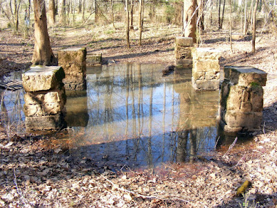
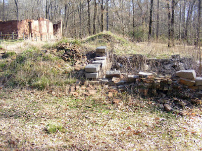
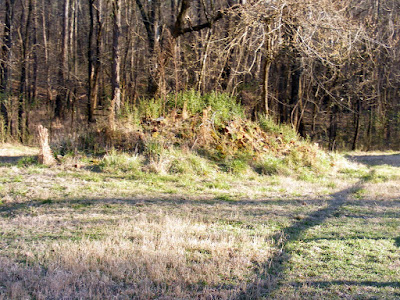
What the area has to offer has two major components: Cool Old ruins of Old Downtown Skull Shoals and a rich history. The most intact of the ruins is the company warehouse store, but there are also remnants of an old toll bridge, the manager’s house, a power plant, and an old brick bridge. Smaller ruins include a worker’s house and the blacksmith’s house. We really enjoy walking around old ruins, so this was fascinating to my group.
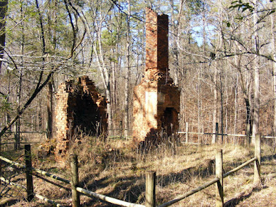
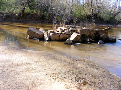
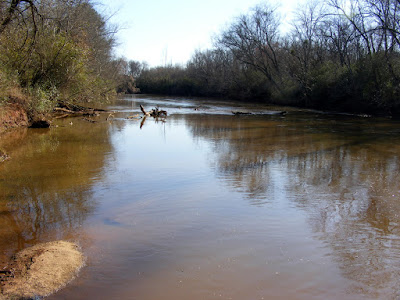
The town of Skull Shoals was at one point a thriving community of 500-600 people. The Factory was the first Paper Mill in the South. It is listed on the National Register of Historic Places. At times, it was the largest employer and largest slaveholder in Greene County, Georgia. This was the golden age for the town between 1840-1920, and its is from this time period that most of the ruins are from. The ominously named town was home to a series of setbacks, fires, murders, droughts. The worst of which was floods; one of them was so fierce that it actually carried the waterway’s toll bridge away. The city was strategically located on the river, but unfortunately also situated in a flood plain. It can flood even today and you can see the erosion of the waters if you walk along the riverside path.
But there’s more to the history that just the Scull Shoals Manufacturing company town. The area was actually inhabited by Lamar Moundbuilding Indians some 6 centuries prior. There are two mounds built by these Indians within two miles of the ruins. I actually didn’t know to look for them or where they were upon my arrival, so I have no details, but I include the directions to the spot as detailed in Hiking Georgia
The capacity to visit Skull Shoals today has a lot to do with the hard work of the Friends of Scull Shoals and their associates. They have done a lot of work to excavate and catalog the area’s history. They even have guided tours by a gentleman who has written a history of Scull Shoals and festivals to help make Scull Shoals come alive. The next festival is on May 3, 2008, so mark your calendars if you want to see this area more comprehensively, directed by true experts.
If you treat this as a hike, the town of Skull Shoals is a simple and short series of small loops totaling no more than 1.5 miles. Nothing too strenuous, but something accessible to all ages and interesting due to its ruins and history, as well as views of the water. If you want to extend the hike, you can walk for quite a distance up the Oconee River as we did or try to find the Mound Path detailed below.
Scull Shoals is a real gem less than two hours drive from Atlanta, a bit South of Athens. Peace and quiet, beautiful scenery, rich history, and cool looking ruins. I went there unprepared and was extremely happy with what I found there. You can go there a little more prepared, and have the same or better results.
The Mounds Trail (From Hiking Georgia
For the Indian mound trail follow FR 1234 [Scull Shoals Road] from Macedonia Road for 2.0 miles to FR 1231 and go 0.5 mile to FR 1231A. Turn Right on FR1231A and go 0.5 miles to the end of the road and parking area. The trailhead is at the end of the parking area at the brown carsonite post with the hiker icon and marked Trail 102.
This is a great site! I am sharing with new friends! I have work at a new subdivision in Greene called Del Webb at Lake Oconee, a 55 over community. I hike with new residents there and like to introduce to them places of eco tourism in the 50 miles radius. I also serve on the Friends board and was thrilled to read your article. It also can be a place to find a cache.. that is if you are not a muggle, but a geocacher. TFTF
ReplyDeleteWashington, Feb. 8, 1788
ReplyDeleteDear Sir:
Saturday last, Capt. John Autry was killed by the Indians near the Skull Sholes on Oconee River. Please to inform me if their is an order of Council for me to receive arms and ammunition for this Brigade. If their is I will send for them immediately as I expect the Indians will be troublesome. I ought to receive some instructions from you how to proceed.
Governor Elandly. I am yours & C, Elijah Clark.
Capt. John Autry was my husbands 6th grt. grandfather, he served under Gen. Elijah Clark during the Revolutionary War, and afterwards in the local Militia. The above letter from Gen. Elijah Clark to Gov. Elandy, tells of his death, which had occurred on the 2nd. John Autry had been riding alone, when he was scalped and killed, by Creek Indians. This area was know as, "Skull Sholes", even in 1788.
This is fantastic! Love the images and the content
ReplyDelete