 |
| From Amicalola Falls |
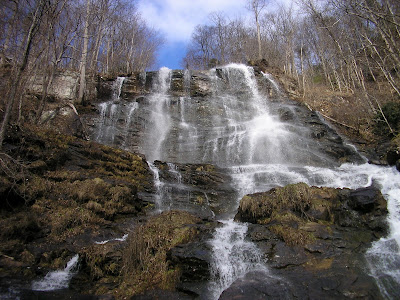
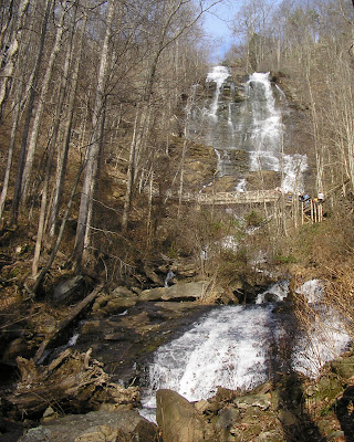
Georgia has a number of fantastic scenic wonders , and one of the most grand is the waterfall known as Amicalola Falls , located a little southwest of Dahlonega in Dawson County. The name comes from the Cherokee word for “Tumbling Waters,” which is apt because the waters tumble down for what seems like miles. Actually, the serious of cascades runs 729 feet, making it the tallest falls in Georgia, and better than 4 times taller than Niagara Falls (Niagara is much wider).

If you park at the base of the falls (parking fee $3, 2007), you can visit the Trail Center before your hike. And see the first walkup for the Appalachian Trail. Mount Springer, which is contained within the park has served as the Southern Terminus for the Storied Trail since 1958. The trail to the top of the falls starts to the right behind the playground area. It’s a pretty difficult walk up. I ran across this description of the ascent from an 1832 surveyor:
"In the course of my route in the Mountains I discovered a Water Fall perhaps the greatest in the World the most majestic Scene that I have ever witnessed or heard of the Creek passes over the mountain & the fall I think can't be less than Six hundred Yards. The Mountain is a least three fourths of a mile high. I made great exertions to get on the summit but the ascent was so great that I was completely exhausted by the time I reached half way. My position was such that I had a perfect view of the entire Fall The Steam is Called Um-ma-eolola from the Fall (Sliding Water)" [Source: www.ngeorgia.com]

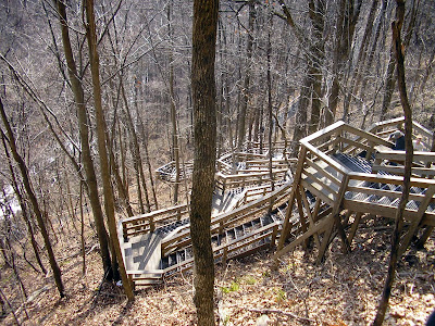
So its pretty tough, but pretty magnificent. You can park at the top of the falls for 5 dollars, but I don’t think that worth it. The best views are distant and take from the bottom. At the top, you would just be coerced to climb down the most convoluted set of staircases seen since M.C. Escher. And once at the bottom, you would just have to climb back to the top to your car.

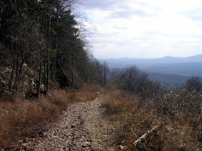
Besides the run around the falls, you could hike around the mountain along the East Ridge Trail, hike the Springer Mountain Approach, Walk to the Len Foote Inn (an affordable lodging for hikers, requires much advance reservation), or meet Posey the tame Possum at the Trail Center (One of the Staff member trained her from a cub).

You can treat this adventure like a hike, or simply a chance to view a natural wonder. Either way, its well worth the trip
Trail Essentials
Approximate Time: 3-4 hours
Approximate Distance: 2.5 to 4 miles
Trail Surface: Compact Soil, Stairs
Features: Cascades, River Views, Athletic Sections
Scenic Quality: A
Athleticism: A
Solitude: C
Value: A
Overall Rating: A-
Parking: $3 (Jan 2007)
Hours of Operation: Open Year Round, Sunlight Hours
Facilities: At the Trail Center and Observation Deck
Maps: Posted at Trailhead and through the Pathway
County: Dawson

We visited these beautiful falls in June 2007. We parked at the top, walked down the trail/stairs alongside the falls and then had to walk back up to get to our car. It was tough! I've since read that the best hike is to park at the bottom, walk a meandering trail up that doesn't follow alongside the falls and then take the steep trail/stairs beside the falls on the way down. I wish I had known this before we went!
ReplyDeleteKathy E.