 |
| From Stone Mountai... |
I’ve been putting this one off for a long time. I didn’t want to write about the Stone Mountain Mountaintop Trail trail until I completed my goal of walking up the mountain 100 times this year. This was the dare the Stone Mountain Songman gave to me last December. And on November the First, I put a hundred in the books.
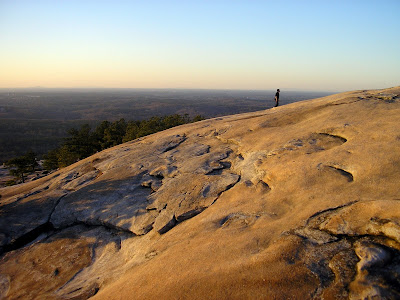
Stone Mountain Park usually wins popular polls to be named the most popular attraction in the Atlanta Area. And its easy to see why. The Rock stands as a monolithic feature dramatically rising above the piedmont. As awe inspiring as it may look from the bottom, the views from the top are more dramatic. That’s one thing I like about walking the mountain: the payoff of reaching the top is always worth the effort.
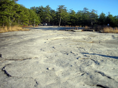
The path itself is approximately 1.4 miles one way, which seems easy enough but its all uphill. There’s no stretch on the marked path, until the summit, that’s flat for more than about 20 feet. As matter of fact, the incline is so intense at points that when it mellows out, it almost seems like you’re not going up.
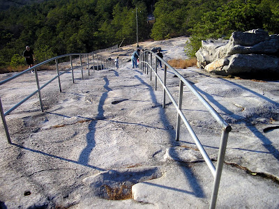
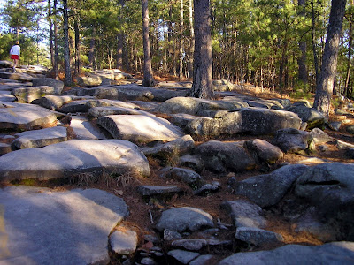
There are several points of interest along the way. At about .3 miles, you’ll see flagpoles on the right. Just beyond that there are the two “bubblegum trees,” actually electrical posts covered with years of chewed bubble gum. At about the mid point, there is a shelter to take a breather. Off the trail to the right of the shelter there is a very old stone fire pit. Going back up the mountain about .1 mile stands the Cherokee Trail Historical Marker. Then you reach the guardrails built to help you up the steepest part (The marked trail also gives an option to go left which will be a little less difficult but a little longer run that goes past bubble gum rock). Just beyond the rails there is another choice to go left or right. Right is the quicker, steeper way and left is the less steep, longer way. And then you made the top. Congratulations!
At the top of the mountain, there is a station with bathrooms, a gift shop, a small snack shop, and some interesting displays about the flora and fauna of Stone Mountain. Just outside the station, you’ll see some yellow paint on the rock. Its actually the remnants of a big sign and arrow, which basically said Atlanta that way: a throwback to days when planes didn’t have sophisticated guidance systems to navigate between cities. It stands to reason that this was the most easily observable feature from a plane. There are also tiny Fairy Shrimp that “magically” appear and live in the crevices of the rocks after rains create puddles, but I’ve not been able to see them.
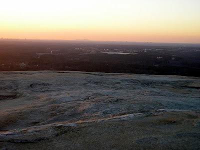
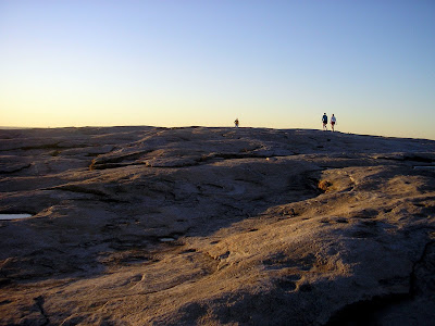
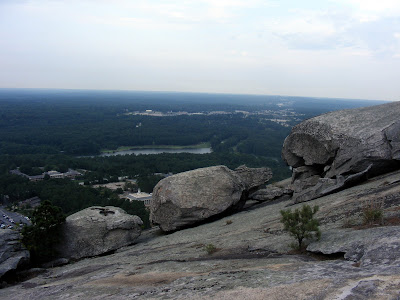
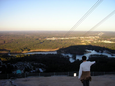
And then there’s the views from the top. You get an excellent view of the city. You can see Kennesaw Mountain to the West. There are a couple of those quarter operated binocular devices up there, so you might want to bring some change.
And then you can go back down. I’ve been able to find at least four other distinct trails besides the clearly marked yellow trail. So if you go several times, you can try other paths. The path scales a height of about 640 feet in just over a mile, so it’s a pretty difficult go. There’s no shame in taking a break or two. If you want to push the envelope, I can get up the mountain in less than 20 minutes (I‘ve made it up and down with a best time of 35:19).
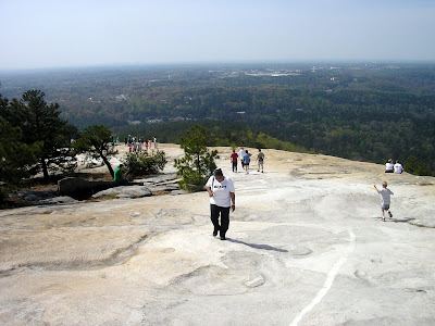
The only drawback to the trail is that it is often heavily congested. I like a little peace and tranquility on my journeys, and its sometimes hard to find it on this path. Especially on weekends or when the weather is too nice. As we move into winter, you will see fewer and fewer folks on the path, but you have to dress warmly, as the wind whips like you wouldn’t believe at the top of the mountain. Conversely, the frequent fellow travelers make for the occasional lively conversation and makes this one place I think anyone would be safe venturing alone.
I dare anyone to have at it 100 times. If you make it let me know, I will tell the world your story...
Trail Essentials
Approximate Time: 1-1.5 hourx
Approximate Distance: 2.5 miles
Trail Surface: Rocks, Rocks, and More Rocks
Features: Challenging Trail, Historical Markers, Information Center, Tremendous Panoramic Views
Overall Rating: A-
Scenic Quality: A-
Athleticism: A
Solitude: C-
Value: A
Parking: $8 (NOV 2007)
Hours of Operation: Open Year Round, except Christmas
Facilities: Bottom of Trail (always open). Top of the Mountain (closes with center)
Maps: Available at Gate or at Confederate Hall, Path Marked with Yellow Paint, Online here
County: DeKalb
No comments:
Post a Comment