Amicalola Falls

THE WATERS COME TUMBLING DOWN...map
From Amicalola Falls

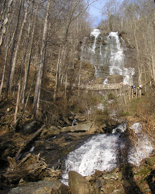
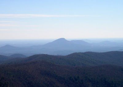
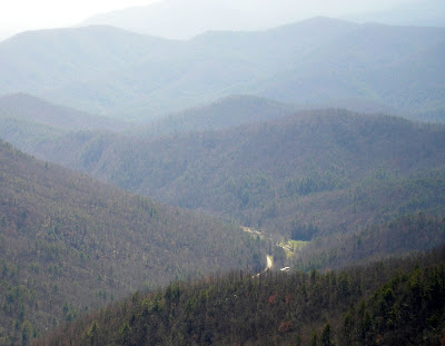
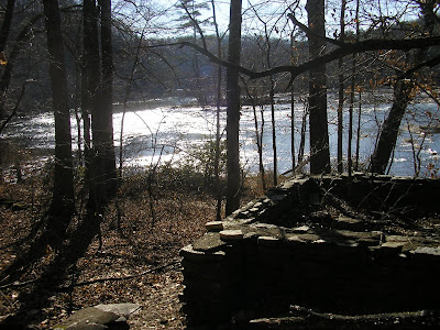
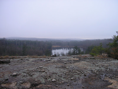
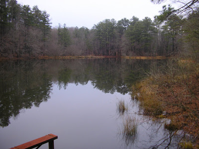
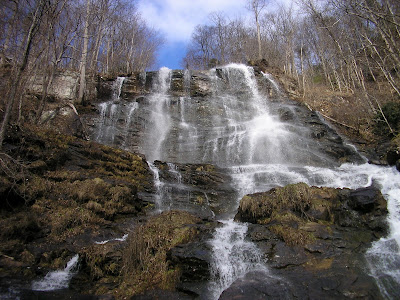
Georgia has a number of fantastic scenic wonders , and one of the most grand is the waterfall known as Amicalola Falls , located a little southwest of Dahlonega in Dawson County. The name comes from the Cherokee word for “Tumbling Waters,” which is apt because the waters tumble down for what seems like miles. Actually, the serious of cascades runs 729 feet, making it the tallest falls in Georgia, and better than 4 times taller than Niagara Falls (Niagara is much wider).

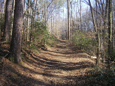
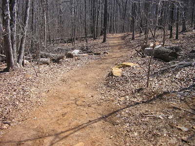
If you park at the base of the falls (parking fee $3, 2007), you can visit the Trail Center before your hike. And see the first walkup for the Appalachian Trail. Mount Springer, which is contained within the park has served as the Southern Terminus for the Storied Trail since 1958. The trail to the top of the falls starts to the right behind the playground area. It’s a pretty difficult walk up. I ran across this description of the ascent from an 1832 surveyor:

"In the course of my route in the Mountains I discovered a Water Fall perhaps the greatest in the World the most majestic Scene that I have ever witnessed or heard of the Creek passes over the mountain & the fall I think can't be less than Six hundred Yards. The Mountain is a least three fourths of a mile high. I made great exertions to get on the summit but the ascent was so great that I was completely exhausted by the time I reached half way. My position was such that I had a perfect view of the entire Fall The Steam is Called Um-ma-eolola from the Fall (Sliding Water)" [Source: www.ngeorgia.com]

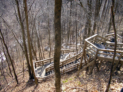
So its pretty tough, but pretty magnificent. You can park at the top of the falls for 5 dollars, but I don’t think that worth it. The best views are distant and take from the bottom. At the top, you would just be coerced to climb down the most convoluted set of staircases seen since M.C. Escher. And once at the bottom, you would just have to climb back to the top to your car.

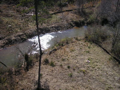
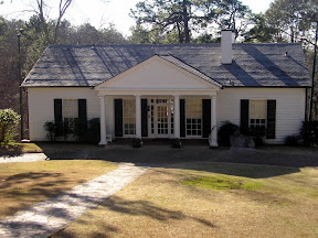
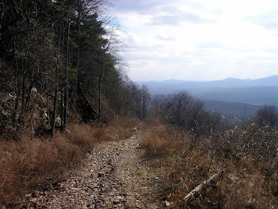
Besides the run around the falls, you could hike around the mountain along the East Ridge Trail, hike the Springer Mountain Approach, Walk to the Len Foote Inn (an affordable lodging for hikers, requires much advance reservation), or meet Posey the tame Possum at the Trail Center (One of the Staff member trained her from a cub).

You can treat this adventure like a hike, or simply a chance to view a natural wonder. Either way, its well worth the trip

Trail Essentials
Approximate Time: 3-4 hours
Approximate Distance: 2.5 to 4 miles
Trail Surface: Compact Soil, Stairs
Features: Cascades, River Views, Athletic Sections
Scenic Quality: A
Athleticism: A
Solitude: C
Value: A
Overall Rating: A-

Parking: $3 (Jan 2007)
Hours of Operation: Open Year Round, Sunlight Hours
Facilities: At the Trail Center and Observation Deck
Maps: Posted at Trailhead and through the Pathway
County: Dawson

Pumpkin Vine Creek Trestle

THE DISAPPEARING RAILROAD BLUES...map
On the West side of town, there exists a path known as the Silver Comet Trail. An ambitious endeavor to build a path for bicyclists to be able to travel from Atlanta to the Alabama border and beyond. This multiuse trail is more for the bicyclist than the hiker, because of the distance to cover, but there are some interesting points along the way if you just know where to look.
The Silver Comet Trail is built almost completely upon the one of the great rail routes that helped turn Atlanta into the great city it is. It’s unfortunate that the railroads are gone, but you can, to some extent relive the experience by traversing this multiuse path.
One of the points of interest is the 126 feet high Pumpkin Vine Creek Trestle, where you can walk (or Bike) across the creek valley as if you were a locomotive. I was a little disappointed in the view from the trestle for two reasons. There was this housing development too close to the Southwest, and Pumpkin Vine Creek was fairly puny. However the Trestle itself was pretty impressive.
You can reach the Trestle by parking at the Rambo Station (so called because of the Rambo Nursery situated just next to the lot. And walking about a mile West to the Bridge. The Station is on the West side of Dallas on Highway 278. Just look for the signs for the Rambo Nursery.
I’ll write more about the Silver Comet Trail at a later date. A quick note is that if you continue up the trail across the trestle in about 8.5 miles you will reach the Brushy Mountain Tunnel.

Stone Mountain Sunset

Atlanta’s Sunset Tradition...map

From Stone Mountai...

One of my favorite places to go is Stone Mountain Park. I Know its got an awful history with the Civil War Memorial and the Rebirth of the Klan and all. But it doesn’t take away from the beauty of it.

I feel like U2 on the Rattle and Hum album when they were talking about Helter Skelter. “Charles Manson stole the song,” they said, “We’re stealing it back.” I feel the same way about the mountain: It’s a beautiful piece of Nature, I’m taking it back, personally. The Rock is the Rock is the Rock, it is not racist or anti-union or anything bad. Hell, Stone Mountain is a Black dominated town. I take a little solace in that it would make those commemorated on the side of the rock turn over in their graves.

I will speak at length about the park at a future time. There are two terrific hikes there. Today, here is a simple tidbit.
Go to the top of the mountain and watch the sunset. You can climb the 1.4 miles up (The recommended route) or take the SkyRide up. The walk up should take no more than 35 minutes and it’s a pretty difficult stretch. But you owe it to yourself to do this at least once.

The amazing thing about it is that the sun sets right through the middle of downtown Atlanta. Sunsets are beautiful in and of themselves. This, to me, should be the official Atlanta way to watch the Sun pass into tomorrow.

And remember, Go to the top of the mountain and watch the sunset.

AT Rocky Mountain Trail

HOW NOT TO HIKE...map

From AT Rocky Moun...
This story needs to be told. It’s a story of poor preparation. We are instructed to carefully prepare and we don’t learn until the mistake teaches us an invaluable lesson. Its also the story of my first time on the Appalachian Trail. It also a story of some really nice folks you can meet away from the city. And then of course there’s plenty of pictures.


I don’t often go to the woods alone. On this occasion, I was going with two really close friends, one male and one female. The female has been on many expeditions with me, but none of us are super experienced hikers.

The other person wanted to go up to Helen, Georgia and get a beer. I order to unite our two passions, I decided that I would like to climb up the 7th Highest Mountain in the state of Georgia, just outside of Helen, Tray Mountain.

I downloaded and drew up a detailed plan. We were going to Andrews Cove Recreational Area, make the 2.5 mile hike along the river , reach the AT, turn right and head two miles up the mountain to the top of Tray Mountain. It should take us about 3-4 hours and we could be in Helen, Georgia in front of a Pint of Beer by 5pm.

Well, that’s where we went wrong. Andrews Cove was closed. Not to be put off, we continued hunting around for a different approach. I wanted to get closer to the Mountain, but we found the Shallow Creek Access point a few miles up 75. We were climbing the 3600 foot Rocky Mountain, instead of the 4300 foot Tray Mountain, but that was good enough for us.

So we entered the toughest expedition we have ever gone on, without a map, without a flashlight, without enough water. I forgot to take an initial compass reading and I was the only one with a compass. We’ll it was fun, exhilarating, breathtaking, and challenging. And in the end, we got pretty lost. We walked at least 8 Miles that day.

That being said there are two things that must be noted. One, the Appalachian Trail is gorgeous and I understand why people are enthralled with it. I will someday do, at least, a multiple day portion of it. Second, is how nice the people in White County, who came to our rescue were.

My one friend made the mistake of wearing new boots on the hike. By about mile six, when we moved from being lost in the woods to being lost on a lonely gravel road, his feet were killing him. We sat to contemplate our situation and a couple drove up, helped us get our bearings, and actually drove him back to our car. There was no way the car could fit three. My other friend and I walked a couple more miles along that road, seemingly getting nowhere, when we stumbled across another couple in their car. We looked at their GPS system and thought we were further away than we thought. This couple made room for us and drove us back to our car.

Well, the story doesn’t end there. Friend one couldn’t come get us because, apparently, I left something on in the car and the battery died. So when we arrived, we saw him just sitting there.

We were now stranded by our car, which was a little better than before.

We managed to flag down another car to get Jumper Cables, and another smaller car with another couple in it to get a battery close enough to make the jump. One of the through hikers actually helped with the jumping. The three of us are very thankful to the Seven Strangers that put themselves out helping us today.

The person who inspired me to start hiking told me, “Nothing bad ever happens on the Mountain, everything bad always happens down there.” He’s right there is a lot of good on the mountain.

Oh yeah, Preparation is very important.

TRAIL ESSENTIALS

Creeks, Cascades, Tremendous Panoramic Views.
Difficulty High.
No real details, but some nice pictures.

CNWR - East Palisades

THE PRETTIEST PLACE IN ATLANTA...map

From East Palisades


In an attempt to experience life more fully, or as Thoreau put it, Live Life More Deliberately, I, much like Thoreau to Walden, went to the woods. The woods might seem hard to find in an urban megalopolis like Atlanta, but seek and you shall find. My inspiration went to experiment on himself with simple living—one hundred and fifty years later, I simply wanted moments of clarity. My experiments will be shorter and more to the point. Like spending life at Walden with ADD and a Blackberry. My two years, two months and two days can only be taken a couple of hours at a time. My schedule won’t allow it. I never set out to be perfect at living, but rather it is my attempt to be better at it. Modern terminology simply calls it hiking.

I found a place inside Atlanta, though the hike takes you just outside of the city, but clearly keeps you inside the perimeter. It has everything a person would want in a hike: Proximity, Physical Challenge, and Beautiful Surroundings. A quick jaunt down the Palisades East Trail.


The trail begins along Long Island Creek, but the real payout is the moments along the Chattahoochee River. I won’t go into the ins and outs of the trail except that it is clearly marked and pretty easy to follow. It is basically a big loop with a couple of in and outs. The path is a little difficult primarily because of the steep climbs up and down to river level and the healthy distance pushing five miles.


Once you get to the water, the scenery gets more dynamic. The word Palisades means fence-like structure, as in what surrounded a Castle in medieval times. This is an unnavigable portion of the Chattahoochee River for all but the smallest vessels. You might see kayakers or tubers, but no ships of any size. A tremendous series of rocks blockades the path like a fence. What’s great about this is that you can walk right out onto the water, get your feet wet if you water, and take in a 360 degree view of the mighty river. You then hike up a steep incline to a picturesque overlook for a tremendous long distance view of the River, complete with highways and civilization in the distance. At another spot, there are ruins of a simple cabin, built at a bend in the river, that is still as beautiful today as it must have 150 or 1000 years ago. If you are into plants and animals, there are some majestic blue heron living in the area (I saw two on my trip), and near the end of the trek, there is an immense bamboo forest.


The only drawbacks of the journey are due to the population in the area. Some people don’t respect the natural surroundings and litter. And, because of the proximity to the city, the walk can be quite populated at times. Still, having something this precious so close to where we live, encourages me and brings me happiness.


Trail Essentials
Approximate Time: 3 hours
Approximate Distance: 5 miles
Trail Surface: Compact Soil, Rocks
Features: Cascades, Ruins, River Views, Riverside Walk

Overall Rating: A-

Scenic Quality: A
Athleticism: B+
Solitude: C
Value: A

Parking: $3 (Jan 2007)
Hours of Operation: Open Year Round, Sunlight Hours
Facilities: None
Maps: Posted at Trailhead and through the Pathway
County: Fulton
Directions: Exit 16, I-285, South on Riverside. Turn right on Mount Vernon, then left on Northside Drive. Right on Indian Trail and enter the park.

Little Mulberry Park

A PARK TO MAKE HIKERS HAPPY...map
From Little Mulber...


I want to say that I have got to hand it to the Gwinnett County Parks Department for the things they are doing with their parks. Especially, the newer parks. I am going to talk about one of them. Little Mulberry Park gets the first nod. Not because its my favorite (It’s not), nor because it’s the best (I can’t make that judgment), but simply because its very good and has nearly everything a park should have.
The park runs in three phases. First the Park you would expect anywhere. The pleasant paved walkways perfect for new mothers pushing their strollers. Maybe a pretty little pond here. A picnic shelter there. The well placed children’s playground. Open fields for soccer or a game of bocce. The second phase is what draws me to this place. It has this series of trails that encompass about six miles that make you feel like you are in the middle of nowhere. Primarily because you are in the middle of nowhere. The path is well marked and fun to hike with a great walk down and up into a ravine.
At the bottom of the ravine, and in a few places throughout the park stand these weird Stone Piles. The signs state that no one knows why they are here and what purpose they serve, but they are protected within the park. I think they are pretty unimpressive, but apparently it falls with several of Georgia’s Strange Indian phenomena, like the Eatonton Eagle, the Three Mounds, ore the Fort Mountain Ruins. Anyway, they are not too spectacular, but nice to look at.
I was impressed with the Wildlife within the park. I saw what I believed to be a hawk. I stumbled across a pack of deer. I saw many ducks in the water. I ran into four fellow travelers on horseback. Smack dab in the middle of the Second Phase is a wildlife reserve. There is a very pleasant cascading waterfall along the entry path. This part is paved and a nice place of Bicyclists or Roller bladers. The Third Phase has a good size lake. There are places where its legal to fish from and places to picnic. This area is primarily paved and a bit less good for solitude.
Trail Essentials
Approximate Time: 4 hours
Approximate Distance: 7 miles
Trail Surface: Compact Soil, Rocks, Paved
Features: Cascades, Indian Artifacts, Lake Views, Wildlife
Scenic Quality: B
Athleticism: B
Solitude: B
Value: B
Overall Rating: B
Parking: Free (Mar 2007)
Hours of Operation: Open Year Round, Sunlight Hours
Facilities: Restrooms in Phase I and III
Maps: Posted at Trailhead and through the Pathway, online
County: Gwinnett

Wynne-Russell House

THIS OLD HOUSE - LILBURN...map

From Wynne Russell...


Not to far from my home and only a few dozen feet from the hustle and bustle of Lawrenceville Highway, stands the oldest house in Lilburn. The Wynne-Russell home. The house sits, appropriately, on Wynne Russell Road, about a block North of the Indian Trail/Killian Hill Road, behind the Prudential Building. The house was built in 1826. I apologize that I get kind of fascinated by old things. I think its nice to get a sense of history. Especially, history in Atlanta that predates the Civil War.

There are a couple of things that strike me when I observe the house. First, how simple the house is. Its easy to get the idea that everybody lived in giant plantations in the South, but it seems that wasn’t the case for the most part in Old Gwinnett. Sort of stands to reason considering the hilly topography making large scale farming unworkable. The second is the placement of three fireplaces in so small a home. Well, I guess it got cold in 1830, just like today, and the fireplace was state of the art heating at the time. The fireplaces are made out of Georgia Red Clay. Third is the small grave yard at the back of the house. There you get the tombstone of Thomas Wynne, James Wynne and Mary Wynne. Thomas, the original builder of the home fought in the War of 1812. James, his son, served the Confederacy during the Civil War.

Some of the reading about the house, marvels at how poor Mary raised nine children under the age of 18, while running the farm after her husbands passing. A remarkable pioneer woman they call her. Well, she did have 10 slaves. That was the last thing I was struck with. To me, Slavery was always a horrific period in American history, but it was somehow distant. This was the first time I spent time on land that actual owned people lived on, it really put the situation into perspective, made it more real for me.

The house was kept in the family until 1971, when the last remaining descendent “Miss Mary” Russell passed on (hence the Russell in the house name). Years later the City of Lilburn took the site over and now uses it as a meeting hall and for special occasions.

There is a nice small parking lot and three picnic tables on the property. If I worked near here, I might choose to pack a lunch and eat it at this serene and nostalgic spot. Heck, if you pull through the nearby Burger King or Chick-Fil-A, you might think about stopping a moment here instead of eating in your car. I promise it’ll be easier on your stomach, and it might just be nicer on your soul.

Arabia Mountain

STONE MOUNTAIN'S OLDER, QUIETER BROTHER...map

From Arabia Mountain


About 20 minutes outside the city, lies a pretty and peaceful Nature Preserve, known as Arabia Mountain. It’s not far from the Stonecrest Mall on East 20. They even have a nice little website.


The hike starts at the Southern Parking lot, though there are other options for parking and starting. The trail starts with stone piles marking the path up Bradley Mountain (960 feet above sea level, about 180 feet up). Then down alongside a pretty private lake, and then back up the slightly shorter Arabia Mountain. I don’t know why they call this the Arabia Mountain, but they do. The surfaces of the mountain are reminiscent of what old movies thought the moon would be like. It has this cold, distant, beauty and charm to it. Maybe that’s why they shot parts of f Pet Semetary II here.


You then cross the street (Klondike) and enter the Quarry Area. There are some good flat surfaces and some interesting cut rock. There are also two office building ruins, which look like some sort of medieval jail. In the middle of the park there is a very active frog pond. For flower lovers, this is one of the few places in the world you can find the endangered species known as Small’s Stonecrop or Diamorpha smallii

There is also a very nice board walk area around and by Arabia Lake. The park is also part of the PATH system, with areas great for Bicyclists.


The map for the hike is on-line here

Trail Essentials
Approximate Time: 3 hours
Approximate Distance: 6 miles
Trail Surface: Granite, Rocks, some Compact Soil, Paved Roads
Features: Ruins, Mountain Peaks, Lakeside Views, Unique Flora
Overall Rating: B+
Scenic Quality: A-
Athleticism: B
Solitude: B
Value: A


Parking: Free
Hours of Operation: Open Year Round, Sunlight Hours
Facilities: None
Maps: Posted at Trailhead & Online
County: DeKalb
Directions
. Take I-20 East to Exit #74 - Evans Mill Rd/Lithonia.
. Turn Right off the ramp onto Evans Mill Road.
. At the light continue straight onto Woodrow Dr.
(Evans Mill Road turns to the right. Do not turn right!)
. Travel on Woodrow Drive for almost 1 mile to stop sign.
. Turn right onto Klondike Road and travel approximately 1 mile.
. Continue on Klondike Road past Rockland Road.
(caution light at intersection)
. To park at north parking lot for the nature center:
turn right at 2nd driveway
. To park at south parking lot:
continue on Klondike Road another 1 mile.
turn left at entrance drive
park here to access the mountain.

The Atlanta Thrashers

THE STANLEY CUP IN ATLANTA...map

Then you go to da box for 2 minutes by yourself... and you feel shame... then you get free
- Eddie Lemieux, explaining the penalty box in SLAPSHOT

>


I like sports. And I think that everyone knows that Atlanta has got the major sports covered. I sit here today and one of our teams is in first place. It isn’t the Braves, it surely isn’t the Hawks, and, of course, its not the Falcons.

It’s the Thrashers. Yep, NHL hockey. Right here in the ATL. Old time hockey..
Eddie Shore would be proud. And, unfortunately, no one’s talking. I felt compelled to say something.


I listened to the game on my way home tonight on 680 the Fan. Dan Kamal is awesome at play by play. It was like listening to the original six with my grandpa. Listening to the quick goals by Kolvachuk, Belanger, Sim (twice), and Vigier got my blood pumping.


Hockey is a tremendous sport which is simultaneously the most graceful thing you’d ever see and the most vicious. In this way it is something that all humans should be able to relate to.


Additionally, you have to love that our Thrashers made significant moves at the deadline to improve and really run at the Stanley Cup. Keith Tkachuk, Alexei Zhitnik, Eric Belanger, & Pascal DuPuis all bring some real fire to the team. Wish the other Atlanta Teams could learn from them.


Watch the games, go to one or two , listen on the radio. The Atlanta Pro Hockey Team is going to the Stanley Cup Playoffs this year.

Warm Springs, Ga

THE GREATEST GENERATION'S PRESIDENT...map

From Litt
le White ...


Here in Georgia, we have had the honor of three modern era presidents calling the state home. One, Jimmy Carter, was born here. A second, Woodrow Wilson, practiced law in Atlanta. The final one died here. I visited the home away from the White House for one of the greatest Presidents in United States History, Franklin Delano Roosevelt.

About two hours outside of the ATL, Southeast on 85, lies the pretty little town of Warm Springs, Georgia. The town and FDR's relationship to the city were immortalized in the HBO movie, starring Kenneth Branagh, Warm Springs. While I was there, I was struck by how fortunate we were as a nation, to have a President forced by conditions, namely a paralyzing polio condition, to spend significant time among the people. Lord, we could use that now.


I sort of wish I didn't have to do this, but a short (and incomplete list) of FDR's accomplishments must be listed:

1. Only four time elected President
2. Presided over the reconstruction of the Country during and exiting the depression.
3. Created the Securities and Exchange Commission protecting our investments
4. Created the TVA, modernizing agriculture and creating power generation in many locales and the Rural Electrification Act, which brought affordable electricity to areas that were unserved prior.
5. Creation of the Social Security System, the most successful program in the history of U.S. governance.
6. Rallied American Forces and People's Spirits through the bombing of American Ship's at Pearl Harbor and the Great War vs. Nazi Germany.

The town is quaint and small. I was only a little disappointed because the Warm Springs of Warm Springs were listed as one of the,Seven Natural Wonders of Georgia, but they really weren't accessible for viewing. The main springs are still being used by the Roosevelt Institute for Rehabilitation and on hospital property and it would be unfair to the disabled folks to be inundated by gawking visitors.


The Little White House charged a small $7 dollar admission. I thought it was worth it. The first museum had several displays about FDR's reforms and some about Eleanor, and an interesting forked family tree, linking Franklin to his cousin, and fellow President, Teddy. The most fascinating feature was one of FDR's custom fitted automobiles, designed to allow a Polio victim to navigate a vehicle completely by hand. Also, there was a complete wall of canes, mostly handmade, given to the President by fans and followers who had no idea how serious his condition was.


Leaving the First Museum, one can walk up a tribute to the fifty states, each carved out of stone native to that state. Then you approach the White house compound.

The compound consists of three buildings, the main building (the Little White House), Servants Quarters and Garage, and the Guest house. The tour guides are older folk who personify the stereotype of Southern Hospitality in the best possible way. They tell in great detail the story of the last days of FDR.


Inside the Main Building, the highlight is the actual chair that Roosevelt was sitting in when he had the Cerebral Hemorrhage that ended his life. His final words were reportedly, "I have a terrific headache." Additionally, you can see his bed, desk, fireplace, and various other artifacts of the Great President.

FDR was having a portrait done at the time of his demise. That unfinished portrait is hanging in the final museum by the entrance. It is haunting considering the circumstance in which it was created.


The folks at the Site will gladly give you directions to the Rehabilitation facilities public showcase, where you can learn about what created the Warm Springs and many of their rehabilitative techniques. You will be completely enthralled by the swimming pool facilities. Primarily, understanding that they are the very same pools in which the former President swam among the people, and secondly because they are built completely on top of one of the fabled natural springs. Unfortunately, the pools are drained to help preserve them, but there is a simple fountain where you can touch and feel the mineral rich water. The temperature of the Water was 86 degrees on February 20th of this year. For a small donation, you can buy a bottle to fill yourself and take home as a souvenir.


The town was mostly shut down on Monday. But there are quaint little shops that bustle on the weekends, in an area known as Bullochsville. Nearby is the Pine Mountain Trail (Wolfden Loop), Dowdell's Knob (FDR's favorite Picnic Spot), and Callaway Gardens.

ShareThis

Related Posts Plugin for WordPress, Blogger...