Roswell Mill (CNWR-Vickery Creek)

DOWN BY THE OLD MILL STREAM...map
From Roswell Dam


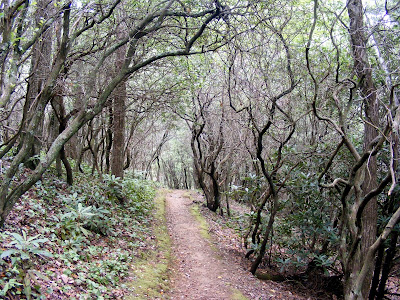
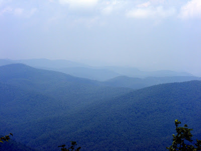
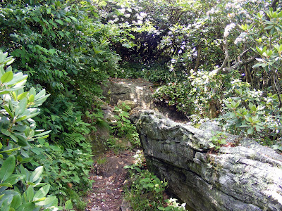
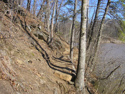
One of the more interesting and near to the city hikes is the Vickery Creek Unit of the Chattahoochee National Wildlife Reserve (Trail Map Here), or as it is better known the Old Roswell Mill Ruins. It is set in Historic Roswell, behind many now affluent stores and dwellings.

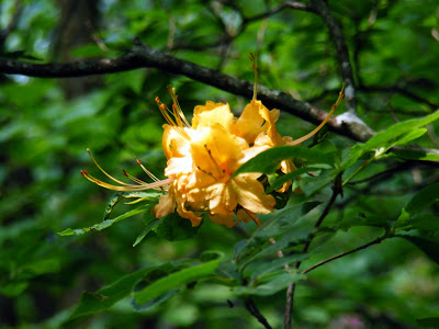
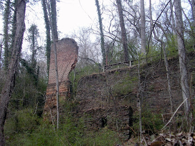
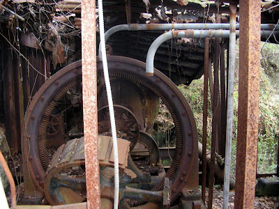
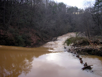
Along the pathway, you will see the remains of the mill, a short waterfall that used to power the factory, and remnants of the water wheels inside other ruins. The area has purposely not be excavated more for the protection of the artifacts themselves.

The Roswell Mill was built in 1836 by Roswell King, who the town and the Mill is named after. He purchased the land from the Cherokees. The factory was known for clothing, especially the Confederate “Roswell Gray” used by the soldiers. General Sherman considered it an important target during the Atlanta Campaign of the Civil War. There are signs in a few spots commemorating and relaying this information.

There is also the story of the abduction of all the women and children who were working the mill at the time of the war. Apparently, there were 400 or so such people who were taken by the Union Army and never seen from again. A nice article about this is provided here . There is a monument to this tragedy in Roswell Park.

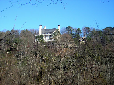
I think this one has all the things I like about hiking Atlanta, historical significance, beautiful surroundings, cool ruins, solitude (if you get away from the mill), and good exercise. It’s a choice location just outside the perimeter that makes it possible to venture out after work or still do something with the rest of the day.


Trail Essentials
Approximate Time: as long as 3 hours, just the ruins about 1 hour
Approximate Distance: 1.5 to 4 miles, depending
Trail Surface: Compact Soil, Rocks
Features: River Views, Riverside Walk, Ruins, Waterfalls, Challenging Trail

Overall Rating: B+

Scenic Quality: B
Athleticism: B
Solitude: B
Historic Value: A

Parking: Free
Hours of Operation: Open Year Round, Sunlight Hours
Facilities: None
Maps: Posted throughout the Pathway, On-line
County: Cobb
Directions: click here

Shri Swaminarayan Mandir Atlanta

THE MOST IMPRESSIVE BUILDING IN LILBURN map
From BAPS Shri Swa...

Just this Wednesday, there was an open house at the Shri Swaminarayan Mandir (Temple) in Lilburn, Georgia. A good friend of the Baboon recieved an invitation and invited me along. It is an impressive structure and will serve as a defining monument in Gwinnett for what they claim will be 1000 years. It is located on the corner of Rockbridge and Lawrenceville Highway, behind the Walgreen's and across the street from the Publix.


The builders of the Mandir are Hindus, specifically BAPS Swaminarayans. They were asked what the tenets of the faith were and they basically said there was no simple answer but stressed service to the community. The pointed us to their website here and their charitable arm website here.


The seemed like nice folks, but there will certainly be a bit of a cultural learning curve for both sides. The public grand opening is scheduled for September 2007, after two weeks of private functions scheduled for the last two weeks of August. The head of the group,Pramukh Swami Maharaj is scheduled to arrive soon after opening for a visit. The main building, the mandir, is a place of prayer and cultural learning. And, according to the speaker, would only hold 200 to 300 people at one time. They are building a family center and auditorium in the second phase behind (to the North) of the Mandir, and that will be of a more modern style.


The Mandir will be the tallest building in Lilburn at a peak of 75 feet, and will be one of the more impressive structures in the state. You can view an artist's rendering of what it will look like here. I like what the AJC article implied. Cobb's got their BIG CHICKEN, Gwinnett now has impressive Taj Mahal looking Mandir. Guess what? We win.

Tray Mountain

IF THE MOUNTAIN WON'T COME TO YOU...map
From Tray Mountain

Just outside of the very popular town of Helen, stand many interesting short wilderness trips. About 9 miles to the north, you can quite easily scale the seventh tallest mountain in Georgia, and the second tallest point on the Appalachian Trail, Tray Mountain. The mountain rises 4,430 ft and can be accessed from several places, depending on the length of the hike you want.

If you turn up the dirt road called tray mountain round, there is a circular parking place a few miles up where you get a simple and straight shot up the mountain that can't be more than a mile with a raise in elevation of about 400 feet. Or you can park on Indian Gap Road where the Andrews Cove Trail ends a run up the mountain from that point (this is the way we chose), getting a raise in elevation of about 1100 feet over 3.5 miles. Or the more adventurous path from the Andrews Cove Trail head or Unicoi Gap, creating much longer hikes of 7-10 miles. Any way you slice it, it is a neat diversion from the touristy (I'm not saying that in a bad way) town of Alpine Helen.

Tray Mountains peak is the boundary for White and Towns counties and from the summit to the north there is a nice view of the Nantahala Mountains in North Carolina. Also, the rare double waterfalls called Anna Ruby Falls, originate from the mountain and can be accessed via Unicoi State Park.
Along our path, we encountered some truly breathtaking views, some very colorful and beautiful flowers, and few interesting day and through Hikers. It was the first time, I've encountered a bear (which is a godless killing machine), I was too shocked to work my camera and it thankfully moved away quickly.

I said in a previous post that the greatest resource of natural beauty in the area is our North Georgia Mountains, The short summit hike is a simple way for anyone to encounter this first hand.

Dr. Martin Luther King Historic Sites

ONE MAN COME IN THE NAME OF LOVE...map
From Sweet Auburn


When I lived in Orlando, People would always come down and ask me, what is your favorite attraction talking about Disney and its kind. I would say vehemently before any of the things you are thinking of you have to go to the beach and, if you can, go see a shuttle or missile launch at Cape Kennedy. If asked the same question about Atlanta, I would say that the Georgia Mountains are our Beaches. And the important achievement of mankind, our equivalent of
American Space exploration is the legacy of Martin Luther King and Civil Rights movement. A person would be a lesser person, and definitely a lesser Atlantan, if you didn't get down to the Martin Luther King Historic Sites of Sweet Auburn.


The whole street is lined with important moments in the progress of African Americans in Atlanta. From Alonzo Herndon's Atlanta Life Building, the first black led Fortune 500 company to the Atlanta Daily World, the first black owned daily newspaper. The top locations are the Martin Luther King Birth Home, Ebenezer Baptist Church, The King Center and the Martin Luther King Historic Site.

The Parking is free at the Historic Site and entry to each section has no charge (though donations are appreciated). The birth home itself can be toured, if you sign up in the historic site early enough. It is notable because of the size of the building. It was a truly grand home with many rooms and a nice backyard. Here it is easy to see how Sweet Auburn earned its reputation as the richest black neighborhood in the USA.


The Church is also open, but requires equal if not more respect than your standard house of God. Most of the day you can sit in the pews and listen to recordings of MLK's speeches. I wound up sitting there for about an hour and a half. If you aren't moved you have no heart.

The focal points of the King Center are the tombs of Dr. King and his wife Coretta. Set in a majestic reflecting pond, it is beautiful and poignant way for a man of the people to remain among the people.

You could visit the tombsite and time of day or night, if the mood presented. The Center building has rooms dedicated to the history of Dr. and Mrs. King, as well as a room dedicated to Mahatma Gandhi.


The National Historic Site is really a museum of the history of the Civil Rights movement. It hit me like the Vietnam Memorial or the Holocaust Memorials. It is important that places like this exist so that we never forget. It also contained a very interesting display on the Atlanta Race Riots of 1906. At the back of the site toward the parking lots stands the first Statue of Gandhi placed on US Federal Lands.


Go see these things if you have never gone. Go again if its been awhile. Take your visitors down there. What was birthed in this three block area changed the world for the better. It is clearly Atlanta's best testament to how great man can be.

CNWR - Gold Branch Unit

CHALLENGING HIKE NEAR THE CITY map
From Gold Branch T...

I went hiking on my birthday. My friends asked me what I wanted to do, and I said go hiking. I wanted a more challenging trail, and they wanted to be in a situation where we were still close enough to drink and celebrate afterward. We are pretty fortunate that right here just outside the Perimeter, amongst the Chattahoochee National Wildlife Reserve, is a good solid but challenging hike at Gold Branch.


Now this doesn't have any cool ruins like Sope or Vickery Creek, and the Water itself is not as pretty as East Palisades or West Palisades. As a matter of fact, its not even the Chattahoochee proper, but rather Bull Sluice Lake, a murky bay along the river. But the draw here is the trail, its narrow, has ups and downs, and just plain fun to hike. All these factors make the route much quieter and much more interesting than other nearby portions of the Chattahoochee.


Directions are available here.

The Trail Map is available here


Now a trail is clearly marked. But you really don't want the marked trail. It is designed for the more casual participant. You want the unmarked primitive trail that basically runs just alongside the river. That is where the actions at.


Along the way, we encountered a couple of giant swans (who came right up to us when we offered a granola bar), a half dozen ducks, some great close up views of the water, views on huge homes off the water. The hike is a little less than five miles and should take a little over two hours to complete.


Trail Essentials
Approximate Time: 2.5 hours
Approximate Distance: 5 miles
Trail Surface: Compact Soil, Rocks
Features: River Views, Riverside Walk, Challenging Trail


Overall Rating: A-


Scenic Quality: B
Athleticism: A
Solitude: B+
Value: A-


Parking: $3 (MAR 2007)
Hours of Operation: Open Year Round, Sunlight Hours
Facilities: None
Maps: Posted at Trailhead and through the Pathway, Primitive Trail unmarked but hugs the lakeshore, On-line
County: Cobb
Directions: click here

ShareThis

Related Posts Plugin for WordPress, Blogger...