The Falls on Warwoman Dell

Chasing Waterfalls 2010 Episode 3 Map
From Becky Branch Warwoman Dell

Heading North to the mountains earlier this year on a hot summers day, a day in which the combination of temperature and demands of life had made us a bit uninspired and lethargic, we decided to make a pit stop to see a waterfall in hopes that the experience might just recharge our internal batteries. We had targeted a site about three miles off Hwy 23 about 2 hours outside of Atlanta on our way to Dillard, Georgia. The place we visited is part of the Warwoman Dell Recreation Area, which has its own small waterfall.


The hike was short, but that’s what we wanted. From parking lot to the falls is an easy walk of about .4 miles. It’s easy but not simple as there is an elevation change of about 300 feet over the course of the trip. We you get to the end, you can’t help by being taken in by the falls, which can best be described as cute. It’s a small 20 foot cascade placed in a little rock nook in the Warwoman Dell Wildnerness. It is a very intimate and pastoral setting. You can literally stand under it in a pool of water not 10 inches deep. The coziness and the tactile possibilities of these falls made this visit very enjoyable.


You can extend the hike by walking the nearby Warwoman Dell Nature Trail that begins on the West side of the parking lot. It takes you in a loop about .4 miles through some pretty trees and has plenty of signs describing and identifying the local flora and fauna. As Warwoman Dell is actually on the Bartram Trail, you could extend your outing by continuing onward to Martin Creek Falls, which lie about .5 miles up the Bartram trail on the West side of the creek. The falls also sit about 12 miles up the trail from the previously posted about Dicks Creek Falls.


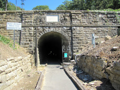
Along the Trail, you will walk very close to a Spring house, where it almost seems like your trespassing through their backyard, but rest assured it is the public trail. There is also the beginnings of a railroad that was never finished, which was intended to connect Atlanta to Midwest markets in places like Cincinnati. The work was cut short by the outbreak of the Civil War. What remains are basically rock steps and a flat bed path, which is what I suggest for you walk back from the falls to complete a .8 mile loop. There is also the Indian History of the Warwoman herself, who was said to have lived in the Area. There is some debate over whom the Warwoman is, being either Nancy Hart of Revolutionary war fame or as the signs on the trail suggest some one of Indian Descent, possibly Nancy Ward (Indian Name Nanye-hi). Or some suggest another unknown Cherokee woman of some stature.


I truly enjoyed my half an hour at the falls and hour on the trails. That being said, I would think this spot would be best enjoyed as part of a serious of short outings in the area, as we did that day. My experience is that my time on or near the Bartram Trail is among the most pleasant , beautiful, and serene of all my jaunts. The Warwoman Dell area is certainly no exception.


Trail Essentials
Approximate Time: 1 hour
Approximate Distance: .8-1.2 miles
Features: Waterfalls, Nature, Railroad Ruins

Overall Rating: B+

Scenic Quality: A-
Athleticism: C
Solitude: A
Value: A
Parking: Free
Hours of Operation: Daylight Hours
Facilities: Outhouse at Trailhead
Maps: Green Blazes, In this Google Book
County: Rabun County


Whistle Stop Cafe

"That frying pan did more than fry chicken that night" Map
From Whistle Stop Cafe


I have said that I was going to talk a little about food (among other things) on this site. But the food has to be a little more than just a cute little restaurant down the road, of which we in Atlanta have plenty. A short while back I was asked a question about my East Juliette Dam post, which I couldn’t answer until I rewatched (at least the first 15 minutes) of the movie Fried Green Tomatoes. During which I remembered that I intended to post about the restaurant about an hour and a half from Atlanta, where the film was made, but never got around to it. Until now, so I bring you the Whistle Stop Cafe in Juliette, Georgia.


Now the film Fried Green Tomatoes seems to be one of those Southern Chick Films (using the film term with absolutely no additional connotation), which I’ve never met a Southern Girl who doesn’t love. So if you decide to go here, you get a two for one as a guy, you make her day a special outing and you get to eat some good fried country cooking without any real questions about your eating choices. A free pass to Fried Chicken, as it were. She’ll love the story and you’ll like the food.


It’s not the restaurant that inspired the book. No, that place is a little café in Irondale, Alabama just this side of Birmingham, Alabama called the Irondale Cafe (I’ve stopped there too and its pretty good). This is the place they chose to shoot the film. You see prior to Fried Green Tomatoes, Juliette was a bit of a ghost town, with packed up and shuttered buildings which made for a good cheap place for a Hollywood set. But when they left, they left some of the film stuff intact, including the café, which some industrious locals decided to reopen in tribute to the restaurant that played such an important part in the film. The building itself was built in 1927 and was primarily used as a general store, but its new function is much more visit friendly.


We ate a big pile of Southern Fried Goodness. We had to order the Fried Green Tomatoes, and I doubt you could make the trek without doing the same. I had a plate full of Fried Chicken Livers, while the missus had a mighty fine country fried steak (I was looking at the menu and I don’t think they sell livers no more). We got them with a bunch of sides, sweet potato soufflé, mac and cheese, and fried okra (though the sides rotate). We also split some peach cobbler, which rounded out a nice traditional Georgia meal. And the setting takes one back to a much less hectic time.


The city itself has undergone a mild rejuvenation because of the Whistle Stop and the Fried Green Tomatoes movie. We stopped for a spell at a kind of opry house with some folks fiddling and strumming on the porch. They run the occasional music fest there, but check for schedules. Out back of the restaurant is the brick oven, they cooked old Frank Bennett in. Also, is the small shack that was the movie home of Smokey Lonesome. If you walk around the little town, there are some neat old buildings, a nice train track view, and across the way in an old mill factory.


So if you are out Southeast of the city, and the timing is right (due to their limited hours), you can get a special treat of good food with a nifty backdrop by visiting the Whistlestop Café in Juliette. I’m sure it’ll be easy to talk your woman into making this stop. I apologize for writing this in a tone which might imply I am a true Southerner.


Restaurant Fundamentals
Address: 443 McCracken Street, Juliette, Georgia (Monroe County)
Hours: Sun-Fri 11-4 Sat 11-8
Phone: 478.992.8886
Website: The Whistle Stop Cafe

Cultural Significance: B
Food Quality: B+
Healthiness: C
Price: A
Value: B+

Overall Rating: B+

Recommendations: You go to a place like this for “Southern Food” so check your diet at the door and stick with the southern stuff: BBQ, Fried Chicken, Country Fried Steak and, of course, the Fried Green Tomatoes and southern sides.
Significance: The location for the movie, Fried Green Tomatoes.

Lilburn Greenway Trail

Biking in my Hometown map
From Lilburn Greenway

If you have been paying attention, you’ll already know the two things about me that inspire this particular post. First, I bought a new bicycle this year. And second, I am a proud resident of Lilburn, Georgia, even though they refuse to acknowledge that fact on matters of trash pickup. Lilburn is a small hamlet of 6.2 miles and at last census was around 11000 in population (2000), which sits just about 4 miles outside the perimeter (30 minutes from downtown Atlanta). Since that census there has been a lot of growth, but it’s still a small town. In April of 2008, amid no fanfare, the Urban Baboon moved its World Headquarters into a tiny, unheated garage in its Southeast Corner. So what do you get when you combine biking and Lilburn? You get the Lilburn Greenway Trail.


Now this isn’t the distance Mecca you can find with PATH or the Silver Comet. It travels from the Lilburn City Park to Rockbridge Road giving you a distance run of about 2.5 miles round trip. And as a short trip, you see a lot of casual walkers, dogs, and bicyclists on its surfaces. But in that short little run it is the closest thing to the holy grail of Atlanta Bicycling: a FLAT clean paved surface. The only hills are really little bridges over small streams. It is the ultimate beginners trail fit for virtual any mobile member of our society.


Also, the Rockbridge endpoint (or entrance from my perspective) sits a scant .75 miles from the majestic Urban Baboon World Headquarters of Lilburn, Georgia. So this means I can Bike out my front door to downtown Lilburn and back in just about 4 miles, which makes for a perfect casual after work activity utilizing about an hour of my life. You can extend the distance by circling the ¼ mile running path, which sits about a quarter of a mile from the City Park and the trail head. If I do it twice, I’m up to 4.5 miles. And since the trail is so pleasant and short, a second run back and forth brings me up to 6 miles.


Along the path, you’ll see friendly Lilburnians, the backyards of neighbors, a few nice bridges, a turtle sculpture, the Rail Line credited with creating the town, and some nice boardwalks to accent the paved surfaces. One important note: although the Northern Entrance to the trail is at Lilburn City park, bicycles are not allowed there. A park without bicycles is like a hot dog without a hot dog bun, sure you can eat it that way, but it will make you feel foolish, but those are the rules. However, at this end of the trail, you can hit the quiet city streets and cruise the old homes of Lilburn, though the town doesn’t have the flat qualities of the standard trail. This is where the parking lot is and parking is ample and free.


In addition, they are planning to continue the trail another mile to bring it all the way to Killian Hill across and to the other side of the park, presumably along the rail line. The ground breaking on this addition began earlier this year. This will bring the trail proper to 5 miles round trip, which will be a great addition to the Atlanta Bicycling (or casual walking) landscape. And if you see a middle aged idiot with his trademark Gold Skater helmet (which I have been told by virtually everybody makes me look stupid) flying by you, you just may have met the Urban Baboon.


Trail Essentials
Approximate Time: 30 minutes
Approximate Distance: 1.25 miles (one way)
Features: Flat Paved surface, stream, rail road tracks, park
Overall Rating: B-

Scenic Quality: B
Athleticism: C
Solitude: C+
Value: A
Parking: Free
Hours of Operation: Daylight hours
Facilities: At Lilburn City Park
Maps:  here
County: Gwinnett

Tunnel Hill

I see the light at the end of the Tunnel Map
From Tunnel Hill

I got lucky this weekend past. I often put things on my list of possible stops along my travels and they are closed and I feel like a moron. But not so this past weekend, I took a two mile detour off 85 to visit a historic place on a day they are usually closed and I stumbled upon their ultimate celebration. I got this lucky in a cool little town a little under two hours Northwest of Atlanta on my way to Chattanooga. The town in question is the city of Tunnel Hill, Georgia and the sight I wished to encounter was their Great Tunnel


The tunnel runs 1477 feet through the Chetoogeta Mountain. It was completed in 1850 and served as the first rail tunnel through the Appalachian mountains and served to connect Augusta and the new town of Atlanta to the Tennessee Valley and up the Northern Coast. It was dedication in October of 1949 and the first train passed through on May 9, 1850. Prior to that railcars were literally portaged over the mountain. The tunnel over time became functionally small so a new tunnel was built a few hundred feet North of the original in 1928 and this one fell into disuse. The tracks were stripped out of it some years later and it was opened to the public in the year 2000.


We arrived on one of the few Sundays the Tunnel Hill Heritage Center was open. They were doing their annual Reenactment of the Battle of Tunnel Hill. We arrived near the end but the ordnance fire was loud and set a beautiful aural tone. There were all sorts of folks in period attire with a nice little market and some of the best handcrafted birch beer I ever drank. We crossed a small covered bridge on foot and made our way to the tunnel. You can now walk the 1500 feet through the old tunnel to the other side. It is a marvel of pre-civil war engineering and makes for cool shade on a hot Georgia day. It is reasonably well lit, but we sort of wished we had brought flashlights. On the other side of the tunnel there was a tremendous patch of kudzu in bloom, with a gorgeous sweet smell. You also get to tour the small railroad museum and walk very near the Clisby Austin House, a fine antebellum building.


Of keen interest here is the history. First there’s the railroad and the tunnel. Secondly, there’s the Civil War heritage. The Clisby Austin home served to house General Hood of the grey and General Sherman of the blue at different times. One of the quirkier landmarks I’ve seen is here and is the gravesite of General Hood’s Leg, which was blown off in battle. The Battle of Tunnel Hill is said to be the first skirmish of the Atlanta Campaign and the campaign was designed in the Clisby Austin home. The tunnel was also one of the targets of destruction by Andrews Raiders during what has become known as the Great Locomotive Chase, but their pursuers were too close by the time they passed through this site. Having all the confederate and union soldiers walking around really brought this history home.


The tour normally costs $5 (hours and admission). And you get to see all the sites mentioned. On the day we went, it was pretty crowded being the big reenactment day and all, but I imagine on normal days it could be quite tranquil and serene. And with its location so close to the 85 corridor, I mark Tunnel Hill as one of the best little roadside attractions I’ve encountered in Georgia, period.


Trail Essentials
Approximate Time: 1 hour
Approximate Distance: 1 mile
Features: Tunnel, Historic Building, Gravesite, Civil War history

Overall Rating: B

Scenic Quality: A
Athleticism: C
Solitude: C+
Value: A-
Parking: Free
Hours of Operation: Monday through Saturday 9am-5pm
Facilities: At Railroad Museum
Maps: None needed
County: Whitfield


Been Quiet a long time

 When I was 10 years old, I knew nothing, and let everyone know it. At age 20, I knew everything, but was wrong it that assumption, but still was happy to unleash this lack of understanding on anyone I could find. Upon turning 30, I knew very little, but at least I learned enough to keep my mouth shut. Now, that I’m slightly North of 40, I’m beginning to think that keeping mum is doing a disservice to the world, or at least to me, because there are too many people listening to folks who think they know everything. So I think it’s time I find my voice again.

I’ve built this little site and it’s mine to do with as I wish. Please understand I’m not going to stop doing what I am doing, but with some regularity, I will indulge myself with posts about other topics. Some will be without controversy, like restaurants and books and music. Some will be thoughts about the future in regards to things for which this site is already known. Some might be about promotions or events in the area. But, some may draw the ire of some folks especially if I touch on sensitive topics like politics or religion. My intent is not to offend but to put forth one rational voice into the ether in hopes of inspiring, at minimum, conversation in a pleasant manner. 

I’ve changed the names of the works about visiting places from “posts” to "articles." And these articles will continue be the driving force for the website. I will use the term “posts” to refer to anything I write, including messages such as this. On the plus side, it will most likely keep me posting longer into the season, with shorter “vacations.” And, if you care, you will learn a little more about me. On the down side, I understand that many of you hold differing opinions from mine, and you may not like this. I apologize up front for that. But I know that the posts where I expressed more of how I truly felt drew the most feedback. So I believe there is a demand for this type of endeavor. If you disagree or need to be heard, the comments form is there for you to use. I will continue to only “moderate” comments that are spam, use offensive language, and that are not in English.

The nature of the site will remain unchanged. It is still about one man’s journey trying to find the cure for birth and death in life. And sometimes these cures are a bit more than moments alone in the woods. Thoughts are a large part of my life, so I beg your indulgence about allowing me to bounce these thoughts off you, my reading public.

Smithgall Woods

Helen’s Nature Retreat Map
From Smithgall Woods
The third most travelled to destination in Georgia is Alpine Helen. And it might be my most travelled to area because of its receptiveness to the outdoor adventurer. There are several interesting places to hike in the general vicinity. One place eluded me until this year. You see every other time I went hunting was in full force and I simply don’t chance that stuff and find other places to go. But in March of 2010, I was able to make my way into Smithgall Woods Conservation Center and enjoy some of the 23 miles of hiking and biking available to folks such as us.


Unlike most of the area’s outdoor excursions, this one is set up more like a retreat center than a wilderness area. When you enter the wooden fence, you get that feel immediately. I have already mentioned the hunting done on premises, but it is also one of the premier trout fishing destinations of North Georgia. Dukes Creek runs right through the middle of it and its pristine waters make for good fishing as well as a serene backdrop for your day in the woods. The main road, called Tsalaki Trail is paved and takes you to the 5 separate trails designed for the hiker. The trails are mostly short, ranging from .3 to 1.6 miles. We walked four of the five that day, and with the walk up and down Tsalaki, we covered just about 6 miles.


The two most interesting trails are the Ash Creek Trail and Martin’s Mine Trail. Ash Creek explores Dukes Creek and includes two wet foot crossings of the stream, so be prepared. The highlight of this trail is the water itself. Martin’s mine trail was our predetermined destination because we thought it would be neat to see gold mine shafts. There were three different shafts, one of which was filled in, that you could look down. In pictures, they look more like holes in the ground than anything fantastic, but I assure you it was a nice treat on our path. On this trail there was also a minor but quite pretty waterfall, and waterfalls always seem to deliver. The short wetlands path had a nice boardwalk and almost seemed like you weren’t in the North Georgia Mountains. The nearest trail was a simple nature trail, which was ok, and the furthest trail is the Cathy Ellis trail, which we didn’t traverse. There is no dominating mountain climb or deep valley to enter, so I would rate all these trails as very easy, with the possible exceptions of crossing the water on the Ash Creek Trail or the actual climb up to the waterfall, which aren’t difficult, but certainly aren’t simple.


Along the way there are a few other interesting sites. At the Nature Center, there’s a small museum inside and a couple of captive birds or prey outside. Along the Paved Road, you encounter a small covered bridge, called Bay’s Bridge, which was placed there as gift from husband to wife by the Smithgalls, the sites original benefactors. There was also a bee farm, so I encountered my first warning sign that read “Caution Bees.” These added nice extra diversions to our day at Smithgall.


So if you are looking for a getaway from your getaway in Helen, and want a simple but serene day in nature, Smithgall Woods fills this role admirably. Because of the relatively easy trails, I would rate this as a top family destination, and if you include the hawks, bees, and museum, kids are sure to enjoy it. If you fish, you probably already know about this place. I’d advise you call ahead about the possibility of hunting (706.878.3087), it seems the hunting dates are grouped around Helen’s busy Oktoberfest season. Because of the paved middle road, you could bring your bicycles to get from trail to trail. If you go, you ought to take the 2 mile car trip afterward to visit Dukes Creek Falls.


Trail Essentials

Approximate Time: 4 hours (all trails)
Approximate Distance: 6 miles
Features: Waterfall, Riverside views, Marshland, Old Goldmines, Covered Bridge, Wildlife, Bees.

Overall Rating: B

Scenic Quality: B+
Athleticism: B- (mostly because of distances)
Solitude: B
Value: B
Parking: Standard State Park Fee ($5, March 2010)
Hours of Operation: 8a-6p Mo Tu Th Fr 7a-6p We Sa Su
Facilities: At the visitor center
Maps: At visitor center, here
County: White


Oconee Indian Mounds

They can’t all be winners, kid Map
From Oconee Indian Mounds

Now I posted a while back about the really cool ruins at Scull Shoals. In that post, I mentioned that one book I read said there were Indian Mounds not too far from there, but I didn’t go. I went back last year with the sole purpose of finding those mounds and I did. People have asked me how every place I go I seem so excited about. The answer to that question is that if I go somewhere and its underwhelming, I tend to shelve the story. But in response to an email, I bring you the story of the Oconee Indian Mounds Trail (here or here)


These photos were taken in April of 2009, after I went with a different friend and his dog to see Skull Shoals. The ruins there were just as nice the second and third times. It was early enough in the day and my companion was game so I sought out this trail a short distance away. To get there, take the road that was the last chance to turn right headed to Scull Shoals, drive a short distance, take the next left, and go to the end. Trust me it’s not far, I met a man who ran between the two sites as exercise.


The trail itself is only one mile long and flat. Just like anything else in the Oconee floodplain, it has a good chance to be muddy, swampy, and murky, as was the case on our jaunt. When you get to the end you will see signs denoting the historical significance of the area and not to disturb the artifacts. The mounds themselves are difficult to see being covered by trees and at the edge of a pretty swampy area. If you were expecting a mound site akin to Ocmulgee or Etowah, that won’t be the case. There is no doubt of its archeological importance, being two good size Lamar Indian Mounds, but its visual significance is minimal. The picture above is one of the mounds.  But that’s ok, not everything has to be a monumental attraction. The best part of the trip was that a total stranger we met on the trail offered us a beer, I told him I would write about him but I didn’t get around to it until now. I think his name was Jim, and I am sure he worked in some nearby factory in the HR department, so here’s my public thanks (He said he read my site—email me if your him and describe the dog so I will know its you).  It was the second time in two weeks that had happened.


So if you are looking for a tidy little add-on to your Scull Shoals day, this place works. Or if you are the type who wants to soak in every piece of Indian Heritage you can find, you should put the Oconee Indian Mounds Trail on your list. And if you are an actual archeologist, I bet this is stupendous. But if you are looking for great photos, Scull Shoals will probably dwarf this site in your mind.


Trail Essentials
Approximate Time: 30-45 minutes
Approximate Distance: 1 mile
Features: Indian Mounds
Overall Rating: B-

Scenic Quality: C+
Athleticism: C-
Solitude: A-
Value: B
Parking: Free
Hours of Operation: Daylight hours
Facilities: None
Maps: None
County: Greene County

PATH: Decatur to Stone Mountain

Of Bicycles, Burritos, & Beer Map
From Path Stone Mountain to Decatur
As much as the area outside Atlanta serves as a stellar haven for the walking naturalist, the city is committed to making a good place for our adventurers on two wheels. One of the principal leaders in making this city a happy home for Bicyclists is a group known as the Path Foundation. They operate and have planned over 100 miles of Bike trails throughout our area. The longest one on the east side of town is the Stone Mountain Trail, which runs 17 miles from the Martin Luther King Center all the way to Stone Mountain. This post will discuss the Northern half of the Trail with runs from Decatur to Stone Mountain.


Now there are many avid, serious cyclists who run 30, 40, or 50 miles without thinking too much of it, and I do not fit into this category. I am the casual biker, who rides a very durable cruiser who has aspirations of becoming a mountain bike. And because of the out and back nature of this trail we chose to park at Stone Mountain, being closer to our gathering point and bike toward the city, though this trail appears to be more popular in the other direction. And the 18 mile trek is good enough for me.


We parked in the free parking on the Southern side of Main Street in Stone Mountain. There is an additional parking lot about a half mile down Main Street by the Visitor Center. But this is a good place, and there were two other biking groups there when we unloaded our car just before 10 am. From this point the first two or three blocks is on the road headed toward Ponce De Leon, where the dedicated trail commences. The first portion is well kept and Ponce is well travelled by automobiles, so it’s nice to be off the road a little. You have to wait to cross Mountain Industrial Blvd. being the first of a few traffic crossings and one of the busiest. You cross by Melwood cemetery on the right and you could wheel through it a bit if that’s your sort of thing. Once you get to Hambrick Road, you have to cross Ponce and the railroad tracks at this light to stay on the paved multiuse path. As you approach Clarkston, the trail goes on a city street for a spell on a quiet road one block away from Ponce De Leon (or whatever they may be calling that road at this point) called Rowland Street. This road has very low use by cars and is pleasantly flat. Just after leaving the backside of Clarkston, the paved path resumes for a short bit, but then you approach 285. At this juncture, the trail puts you back on the road for about a ½ mile with heavy traffic to cross the highway. This would be the only part that maybe I wouldn’t take kids along for, or at least you could walk your bikes on this stretch. You do continue on the road for about another mile before the paved path resumes. And that trail will continue until you reach Decatur, where you will, once again, have to manage surface streets, albeit quiet ones to continue the path. All in all you visit the towns of Stone Mountain, Clarkston, Scottdale, Avondale Estates, and Decatur.


The scenery is nothing spectacular, with the exception of the approach to Stone Mountain. Most who ride the other direction see this as a goal and you can enter the park for free and cruise once around the mountain as a victory lap. There is also a nice view of some kind of Industrial equipment at the Ready Mix USA plant in Scottdale. The tour behind downtown Clarkston takes you past several churches. As you approach Decatur, there is the Marta Train Yard. The rest of the trip is pretty much road and path with homes and businesses alongside. Some of it is rundown, but much of which is picturesque in its decay. You spend much of the time very near a rail line, which has its romantic elements. About a quarter of this portion of the Stone Mountain Trail runs through park like settings. The trail is reasonably flat by Atlanta standards (which means not really flat), but there are only a handful of moderate climbs and nothing we couldn’t handle.


We made it from Stone Mountain to Decatur in under two hours (like I said we are casual bikers). We locked our bikes behind the courthouse in Decatur and looked for place a few sweaty folks could eat a nice lunch. We settled on Raging Burrito, because of its fine burritos and big open air patio. The folks at the restaurant were very welcoming despite our disheveled appearance, which always means a lot to me. A word of caution: they have great margaritas and a fine beer list, but partaking in these activities makes the ride back much more of an ordeal at least until you burn the alcohol from your system in about two miles. You have guessed right that I am speaking from experience.

So you have another portion of Atlanta’s dedicated bike trails brought to you by the Path Foundation. The other trails I’ve run (Arabia to Panola, Silver Comet) maybe more scenic, but that doesn’t make this one bad, simply the other ones better. I will tell you this, everyone I’ve told that we biked into Decatur for lunch and biked back thought that was an excellent way to spend a day of your life.


Trail Essentials
Approximate Time: 4 Hours
Approximate Distance: 20 miles
Overall Rating: B
Scenic Quality: B-
Athleticism: B+
Solitude: C+
Value: A
Parking: Free, Various Locations
Hours of Operation: Dusk til Dawn
Maps: Stone Mountain to Clarkston, Clarkston to Decatur

Dicks Creek Falls

You Don’t Know Dicks Creek Falls map (approximate)
From Dicks Creek Falls

The longest and most popular trail everyone knows about in Georgia is the Appalachian Trail. It’s a great trail and I’m glad we can lay claim to part of it. But there’s another great long trail that Georgia lays claim all to called the Bartram Trail. I like the Bartram Trail  in at least one way better than the AT, namely the extra solitude you get on it because of its lesser use. And there are great sites to see on this trail. With this post, I will introduce to you the nicest waterfall I have found on the trail, namely Dicks Creek Falls in
Rabun County.


Now don’t confuse this falls with Dukes Creek Falls or other falls that flow on Dicks Creek. This one sits at the very terminus of the waterway as it dumps into the Chattooga River. It is a 1.4 trek along the Bartram Trail just at the point where Georgia ends and South Carolina begins. Now don’t let this distance thing fool you, the trail head sits just less than two and a half hours Northeast of Atlanta up Interstate 985, near Clayton, Georgia.


To get there, you turn right on Rickman off 985 (which has become 23), and take a quick right onto Warwoman Dell. After 5.3 miles you turn right onto Sandy Ford Road. You are going to travel this road for about 3.5 miles. There is a right turn you need to take about a quarter mile up to stay on the road. You will cross Dick’s Creek once on a bridge. The second time you cross Dick’s Creek it will be a splash through, which you can cross to get right next to the Bartram Trail head, or you can park in a field just before it which will add about 1/3 of a mile to your journey on foot (one way). You cross the creek and then begin to look for the signs. The trail to the waterfall is opposite the rock marker for the Bartram Trail.


You walk the Bartram Trail until you get to the bridge. On the opposite side of the creek you turn right and walk until you see the top of the falls (a little more than a half mile away). The trail to the point is relatively easy, except that, as we experienced, it is not well maintained. There were several spots where we had to cross in, around, and through felled trees along the way. The most difficult obstacle, however, was the fact that the bridge was out so we had to make our second and more difficult wet foot crossing, so be prepared. The trail brushes right up against the top of the trail but there is not much of a view from there. You will want to climb down to the river at one of three quick side trails. These trails are tight and at a good incline which will add another quarter mile to your trek and elevate the path from easy to moderately difficult, parts of which you will need to use your hands as well as feet. But, it is well worth the effort.


The first walk out takes you to the base of the falls and offers the best view of the falls and the rocks at the base. Dicks Creek tumbles with a pretty steep drop 60 feet into the river below. I would rate this falls up there with anything I have seen before. The side trail furthest away from the top, prior to the trail turning left, takes you to one of the most beautiful spots in all of Georgia. You get this awesome 180 degree view of the Falls and the Chattooga River. The sounds of the rushing river are actually louder than the falls itself. My suggestion is you go to this place first and work your way back toward the falls.


So what you get is quite wonderful: quiet time in a pristine wilderness, a mild adventure try to find the trailhead, good healthy exercise crossing the creek and climbing up and down to the base of the falls, and a gorgeous view of a fantastic waterfall and the incredibly scenic Chatooga River. If in Rabun County or a waterfall lover, or curious about beautiful places in Georgia, Dicks Creek Falls is a must see.


Trail Essentials
Approximate Time: 1.5 hours
Approximate Distance: 1.6 miles
Features: Remote Wilderness, River Views, Waterfall
Overall Rating: A+

Scenic Quality: A+
Athleticism: A
Solitude: A+
Value: A+
Parking: Free, but limited
Hours of Operation: Daylight hours
Facilities: None
Maps: None found, follow directions in Post
County: Rabun

ShareThis

Related Posts Plugin for WordPress, Blogger...