Elachee Nature Center

Nature Just Off 985 MAP
From Elachee Nature Ctr
On 985 North on my way out to Helen, I had often passed the sign that informed everyone that the Elachee Nature Center was just off Exit 16. I thought I ought to stop in there sometime, being only 35 minutes from my house and easily under an hour from Atlanta Proper. What I found was a very nice place to get away from the city.

The center itself is a major stop for schoolchildren in the area. It has a lot of information at the Nature Museum on dinosaurs and fossils, native birds, and even astronomy. I know a lot of folks find my site when looking for “fun things to do with kids.” This particular spot seems to fit the bill. And at $3 admission for adults, $2 for children 2-12 (Aug 2007), it doesn’t dent the pocketbook much. REI even lists this as a place that makes hiking fun for children. And if you wish to skip the museum and just hike the Trails, there is no cost at all (Parking is even free).

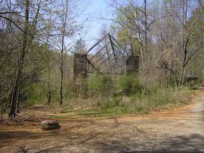
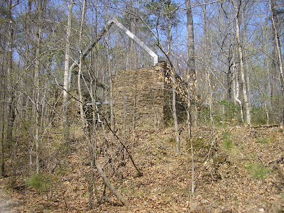
There are several trails running through the Elachee Grounds, including several short trails near the museum center. The most adventurous trails are the East Lake and West Lake Trails that extensively explore the Elachee Creek Watershed. These two trails combined will put you at 4.5 miles roundtrip and contain enough diverse elevations to give your heart a gentle workout.

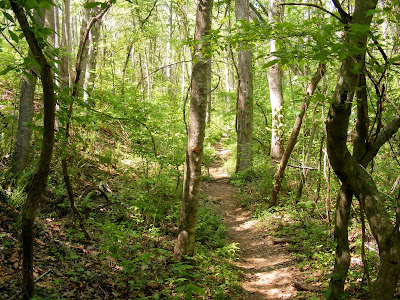
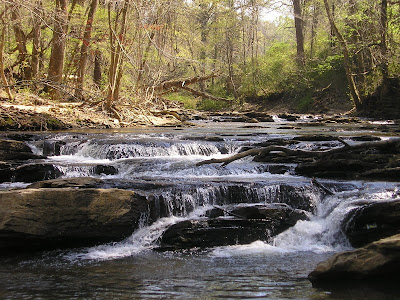
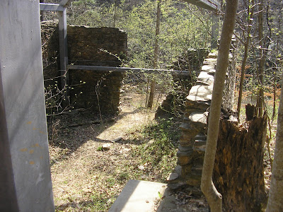
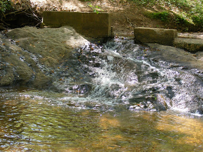
You will see a dense hardwood forest. You will run along side and cross the creek with enough small cascades to fill your ears with gentle sounds. Birds abound in the region and the center folks do everything they can to attract and maintain the avian population (I wish I knew more about birds and plants, but alas I do not).


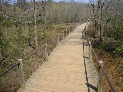
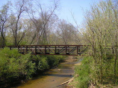
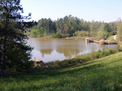
The highlights of the trail are crossing a well built 150 foot long suspension bridge. It sits only six or eight feet above the water, so falling is not a huge concern. And I have never seen a bridge of the sort with sturdier construction, making it about as safe for kids to shake and jump on the bridge without fear of injury. The other is the lake at the end of the trail: scenic, beautiful and filled with local trying their best to catch a big one. The trail itself is very well shaded (except by the lake) making for cooler temperatures in the hot summer months.

It is very nearby the Chicopee Woods Golf Course (the Elachee Nature Center is in the much larger Chicopee Woods Agricultural Center), which is a well regarded Public golf course ($40-$60 green fees), and an extensive mountain bike trail system . So you can bring your bikes, clubs, and a picnic lunch and make a day of it. You will pass both on your way to the Center parking lot.

Trail Essentials
Approximate Time: 3 hours
Approximate Distance: 4.5 miles
Trail Surface: Compact Soil, Wooden Bridges, Some Pavement.
Features: River Views, Riverside Walk, Suspension Bridge, Small Cascades, Lake, Nature Museum

Overall Rating: B+
Scenic Quality: B+
Athleticism: C+
Solitude: B+
Value: A-

Parking: Free
Hours of Operation: Closed Nights, Major Holidays
Facilities: Near the Museum, Near the Aquatic Center (Lake)
Maps: At Trail Head, Signs Throughout, online here
County: Hall

Heritage Park Trail (Cobb Co)

A Walk in the Park MAP
From Heritage Park

As a person always looking for a nice place near the city to get out of the house, get some exercise, and take a walk, I stopped by a really nice newer park in Mableton Georgia, just off the Silver Comet Trail. I always prefer in my walks, good exercise, a little history, a peaceful getaway, and something pretty to look at. I found another nice Atlanta sanctuary in Heritage Park in Cobb County.

Heritage Park must be relatively new because I couldn’t find it on Google Maps. As a matter of fact, its seems to be surrounded by other parks, which I find nice, because it keeps the crowds to a minimum, giving me the break from the city I need. It actually attaches at one spot to the Silver Comet Trail, which even keeps the bicyclists at bay.

Well, as far as Nature goes, there’s some lovely views of Nickajack Creek, along with the Georgia Native Plant Society’s attempt to place a number of Georgia Native Plants in on Central Location for education and awareness. You cross the creek on an ironwork bridge and near the end you see a small, but enjoyable cascading waterfall.

Anything named Heritage Park must have a little history to its credit. On the Trail, you will find the ruins of the Concord Woolen Mills. There are actually two structures from the mills there and the experience is diminished a little by the presence of large metal support structures, designed to preserve the mills, especially during the construction of the East West connector. The Mills were destroyed by the Union troops in a side skirmish during the Atlanta Campaign on July 4, 1864. The Mill was targeted because one of its functions was to produce Confederate Uniforms. The last part of the Mill is unfortunately on private property so it can only be viewed from one direction.

On the Hiking/Exercise scale, this pathway is a little underwhelming, except for the very end of the trail, it seems they have found the only mile of flat land in Northern Georgia. The pathway is 1.7 miles long and requires a round trip to get back to your parking spot.

There are two interesting and very quick side trips you can make. Just before the ruins, there is a way to get to the Silver Comet Trail, and if you take a quick right a go a couple of hundred feet you can walk across a bridge over the East-West Connector and view the beautiful Atlanta traffic. At the very end of the trail, a few hundred feet beyond the Battle of Ruff’s Mill historic marker is the Concord Covered Bridge, the oldest remaining covered bridge in public use anywhere near Atlanta. It too was burnt down in the Battle of Ruff’s Mill but rebuilt in 1872.


Trail Essentials
Approximate Time: 1.5 hours
Approximate Distance: 4 miles
Trail Surface: Compact Soil, Wooden Bridges.
Features: River Views, Riverside Walk, Historic Ruins, Small Waterfalls, Important flora.

Overall Rating: B
Scenic Quality: B
Athleticism: C
Solitude: B
Value: A-

Parking: Free
Hours of Operation: Open Year Round, Sunlight Hours
Facilities: At Trail Head.
Maps: No Trail Marked, but very easy to follow except from the Ruins to the Covered Bridge.
County: Cobb

ShareThis

Related Posts Plugin for WordPress, Blogger...