Ponce De Leon Park

BABE RUTH WAS HERE map


Baseball is America’s game and the game we Atlantans support more and better than any other professional sport. Long before Hank Aaron and the Braves flew South from Milwaukee, there were teams here, and they played at Ponce De Leon Park (AKA Spiller Field) in East Atlanta.
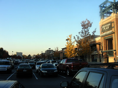


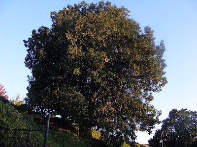
The park was torn down in favor of a parking lot (good call) shortly after Atlanta Stadium (AKA Atlanta Fulton County Stadium) was built in 1962. The distinguishing feature of Ponce De Leon Park is that it was built around a large Magnolia Tree, which for much of its history was in the field itself in very deep right center (when they moved the fences in it stood outside the stadium. All that remains of the field is that majestic magnolia, and it resides stoically behind the Borders, Whole Foods, and Home Depot at Midtown Place across from City Hall East. According to project ballpark, the tree in these photos is that tree, the Atlanta Baseball Tree.
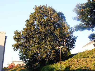


The field was the home to the Atlanta Crackers from 1907-62. They were one of the best teams in the AA Southern Association, winning more games than any other team in the league. I understand that the team was huge in Atlanta, and is understood by reading Lewis Grizzard and the like. The team included players like future hall of famers, Luke Appling and Eddie Matthews, and also had players like broadcaster (and Steve Carlton’s Catcher) Tim McCarver and Manager Chuck Tanner.

It was also the home to the Atlanta Black Crackers (when the white Crackers were out of town) who won the second half of the 1938 Negro Leagues. The Championship that year versus the Memphis Red Sox was canceled for some reason after two games (Atlanta was down 2 games to none). I wish I new more about the Negro Leagues (As a kid I played football at the same stadium the Leland Giants played on years before), but I don’t. Players on that team included: Nat Peeples (The only black ballplayer to play in the Southern Association), Roy Welmaker, James “Red” Moore, Babe Davis, Don Pelham, Joe “Pig” Dixon, Felix “Chin” Evens, and Twelosh Howard, Pee Wee Butts, and Gabby Kemp (who played and managed the team). Negro League superstar Chico Renfroe reportedly started with the Black Crackers as a batboy.
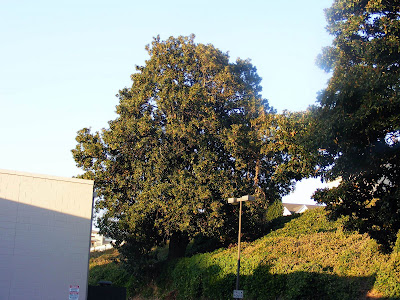


The Tree is significant for another reason. Hitting a ball into the tree was considered a monumental task being about 450 feet from home plate. Only two players ever did it. The previously mentioned Cracker Eddie Matthews was one. The other player was the Immortal Babe Ruth, in an exhibition game vs. the Crackers. Or at least that’s the story I heard. So we have a tree that the greatest slugger in the history of the game rocked one off its leaves right in the heart of the city, and no one cares. I just thought it should be remembered.
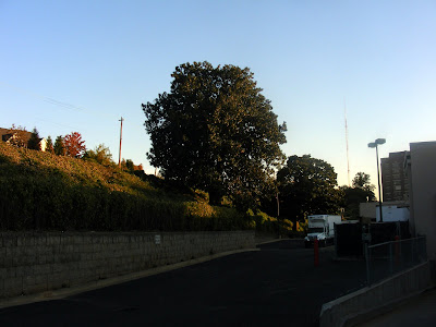


I went back there to take these pictures. There was no plaque commemorating the site. There was sign saying “No Loitering or Trespassing,” so if you go to this place, be respectful. It is on semi-public land, namely a strip mall, so there should be no significant problems.

In response to request: here's one online old photo, you can clearly see the Ford Plant (now City Hall), the tree is in the bottom right corner approaching the traintracks. Photo found on Cycling.Jettmarks.com (an Atlanta Cycling Site)

Sweetwater Creek

THE VANISHED TOWN OF NEW MANCHESTER map
“New
People have been telling me for months, you “gotta go to Sweetwater Park.” And I’ve been putting it off because I’ve learned that nothing can live up to that much hype. (Also, since its only about 15 minutes outside the city, near Lithia Springs, I’d thought I’d save it for a weekend when I had little time to spare.) Well, I went and I can honestly say that I hadn’t had as much fun hiking in a very long time.
“Sweetwater
The trail (map here) has almost everything I want out of a good hike. A little history, something beautiful to see. It’s a little lacking in the athleticism of the trail meaning this is a good hike to take kids along, or if your just starting out or don’t get out much.
“Sweetwater
What it lacks in getting your heart to race due to physicality, it does another way. The Creek itself is littered with Thousands of tiny rocks (Much more extensive than the Palisades) that you can walk (and sometimes jump) across for at least a mile. My friend and I stayed out on the water jumping rock to rock for over an hour. This is why this trip was so enjoyable.
“Manchester
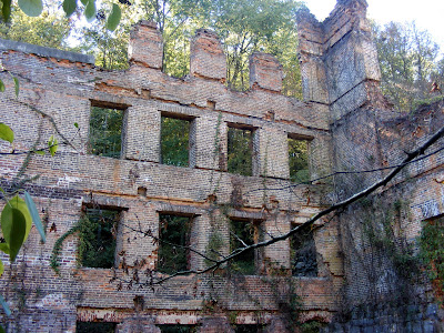
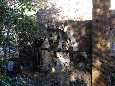
But wait there’s more: Sweetwater Creek is home to the ruins of the lost city of New Manchester. At its peak, the town boasted 500+ residents and was home to the New Manchester Manufacturing Company. The Factory was five stories high (Tallest building in the area at that time) and housed a 50,000 pound waterwheel to power the production. Much like the Roswell Mill, the Company had many orders to supply the Confederates during the Civil War and, much like Roswell, it became a target for General Sherman. (And much like Roswell, many of its women and children were taken away). All that remains is the remnants of the Factory, which stands as a centerpiece to the park.
“Sweetwater
A short distance after the ruins, you will come to a waterfalls area. The falls are short, and with the lack of water we are getting they are nothing spectacular. The cool thing is, with the rocks on the water, you can walk right up to it. It is still a picturesque sight (I took way more photos than I posted here, feel free to click into any of the photos to see the complete gallery)
“more
Now from here you can double back, which will put your adventure at about 3-3.5 miles. Or you can continue on through the wildlife trail back to the trail head. This section is moderately strenuous and will cap the hike out at about 5.5 miles.

So if you here folks talk about Sweetwater as a great place to go, they are probably right. You can find a list of upcoming events at the park here, courtesy of the Friends of Sweetwater Creek.

Trail Essentials
Approximate Time: 4 hours (2.5 if you go to the falls and back)
Approximate Distance: 5.5 miles
Trail Surface: Compact Soil, Rocks
Features: Ruins, River Views, Small Waterfalls, River Rocks
Overall Rating: A-
Scenic Quality: A
Athleticism: C (B- if you go the full 5.5 distance)
Solitude: B
Value: A
Parking: $3 (Nov 2007)
Hours of Operation: Open Year Round, Sunlight Hours
Facilities: None
Maps: Posted at Trailhead, Maps available, or Trail Map (Trails are clearly blazed)
County: Douglas County

Stone Mountain Mountaintop

LET FREEDOM RING FROM STONE MOUNTAIN OF GEORGIA Map
“top
From Stone Mountai...

I’ve been putting this one off for a long time. I didn’t want to write about the Stone Mountain Mountaintop Trail trail until I completed my goal of walking up the mountain 100 times this year. This was the dare the Stone Mountain Songman gave to me last December. And on November the First, I put a hundred in the books.
“Trailhead”
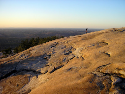
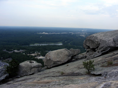
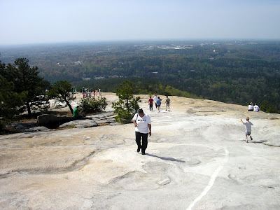
Stone Mountain Park usually wins popular polls to be named the most popular attraction in the Atlanta Area. And its easy to see why. The Rock stands as a monolithic feature dramatically rising above the piedmont. As awe inspiring as it may look from the bottom, the views from the top are more dramatic. That’s one thing I like about walking the mountain: the payoff of reaching the top is always worth the effort.

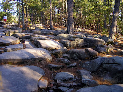
The path itself is approximately 1.4 miles one way, which seems easy enough but its all uphill. There’s no stretch on the marked path, until the summit, that’s flat for more than about 20 feet. As matter of fact, the incline is so intense at points that when it mellows out, it almost seems like you’re not going up.
“Stone
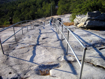
There are several points of interest along the way. At about .3 miles, you’ll see flagpoles on the right. Just beyond that there are the two “bubblegum trees,” actually electrical posts covered with years of chewed bubble gum. At about the mid point, there is a shelter to take a breather. Off the trail to the right of the shelter there is a very old stone fire pit. Going back up the mountain about .1 mile stands the Cherokee Trail Historical Marker. Then you reach the guardrails built to help you up the steepest part (The marked trail also gives an option to go left which will be a little less difficult but a little longer run that goes past bubble gum rock). Just beyond the rails there is another choice to go left or right. Right is the quicker, steeper way and left is the less steep, longer way. And then you made the top. Congratulations!
“Rocks
At the top of the mountain, there is a station with bathrooms, a gift shop, a small snack shop, and some interesting displays about the flora and fauna of Stone Mountain. Just outside the station, you’ll see some yellow paint on the rock. Its actually the remnants of a big sign and arrow, which basically said Atlanta that way: a throwback to days when planes didn’t have sophisticated guidance systems to navigate between cities. It stands to reason that this was the most easily observable feature from a plane. There are also tiny Fairy Shrimp that “magically” appear and live in the crevices of the rocks after rains create puddles, but I’ve not been able to see them.
“Kennesaw
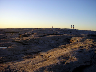
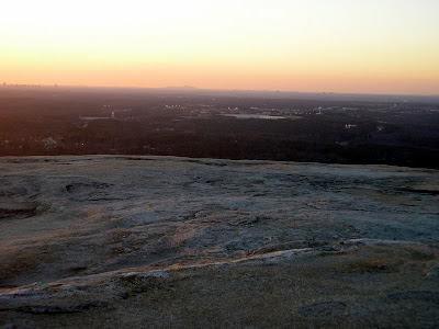
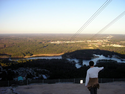
And then there’s the views from the top. You get an excellent view of the city. You can see Kennesaw Mountain to the West. There are a couple of those quarter operated binocular devices up there, so you might want to bring some change.
“rocks
And then you can go back down. I’ve been able to find at least four other distinct trails besides the clearly marked yellow trail. So if you go several times, you can try other paths. The path scales a height of about 640 feet in just over a mile, so it’s a pretty difficult go. There’s no shame in taking a break or two. If you want to push the envelope, I can get up the mountain in less than 20 minutes (I‘ve made it up and down with a best time of 35:19).

The only drawback to the trail is that it is often heavily congested. I like a little peace and tranquility on my journeys, and its sometimes hard to find it on this path. Especially on weekends or when the weather is too nice. As we move into winter, you will see fewer and fewer folks on the path, but you have to dress warmly, as the wind whips like you wouldn’t believe at the top of the mountain. Conversely, the frequent fellow travelers make for the occasional lively conversation and makes this one place I think anyone would be safe venturing alone.
“view
I dare anyone to have at it 100 times. If you make it let me know, I will tell the world your story...

Trail Essentials
Approximate Time: 1-1.5 hourx
Approximate Distance: 2.5 miles
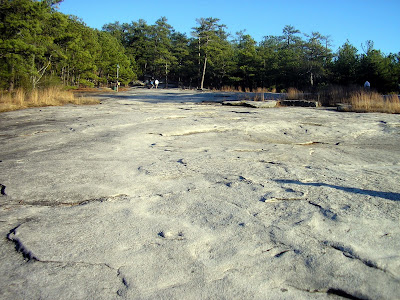
Trail Surface: Rocks, Rocks, and More Rocks
Features: Challenging Trail, Historical Markers, Information Center, Tremendous Panoramic Views

Overall Rating: A-
Scenic Quality: A-
Athleticism: A
Solitude: C-
Value: A

Parking: $8 (NOV 2007)
Hours of Operation: Open Year Round, except Christmas
Facilities: Bottom of Trail (always open). Top of the Mountain (closes with center)
Maps: Available at Gate or at Confederate Hall, Path Marked with Yellow Paint, Online here
County: DeKalb

ShareThis

Related Posts Plugin for WordPress, Blogger...