| From High Shoals |
If your looking for a nice little jaunt of a walk in the woods and you happen to be in the Helen, Georgia area, I’d like to suggest the High Shoals Trail (Scroll Down to Find) in the designated High Shoals Scenic Area, situated about 10 miles North of Helen up 17/75 (the Unicoi Turnpike). If you want something simple, yet pretty, the sort of place just about any age can enjoy, this is the place for you.

To get there you have to make a very sharp right turn (coming from Helen) on to Indian Grave Gap Road. The turn is marked with an appropriate sign. You then drive up this dirt road about a mile and a half until you see a small parking area on the left. You do actually cross a small stream while in your car, so traveling during the more rainy times may require more of an off road vehicle (we got there in a Nissan Sedan, for the record) There is no fee for parking, so the value is built right in.
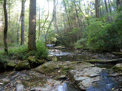
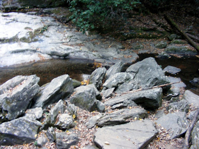
The trail meanders downward over 1.2 miles actually losing an elevation of just over 300 feet. I’ve seen this path marked as moderately strenuous by some authorities, but I don’t believe it, unless you count the short steep sections by the falls or the fact that you climb 300 feet up as you are leaving. Along the way, you will walk through a dense and picturesque hardwood forest, across some small bridges, through hemlock, laurel, and other vegetation (I’m no expert on these). There is actually a series of five waterfalls; three are smaller and unnamed, but the two larger, Blue Hole Falls and High Shoals Falls, have observation decks.
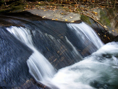
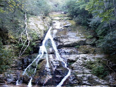
We went in late fall of 2007 after the near record breaking drought so Blue Hole (the first and smaller) was more majestic [what Blue Hole Falls could look like]. The second falls is High Shoals Falls that cascades about 100 feet[what High Shoals Falls could look like], but as you can see from the pictures, it was pretty dried up at our time of visit. I’ve seen Blue Hole listed on the Swimming Holes of Georgia website, so I guess you could bring your swim gear, but there are also signs say to keep out of certain areas.
These photos demonstrate why we always think of waterfalls after rain. The way these falls could look is quite stunning. However, there is a bit of a catch-22 here. If it rains a lot to create fantastic cascades, you may not be able to reach it by car. When you can reach it by car, unfortunately the show will be diminished a bit. Don’t let me dissuade you though. In spite of the humble offerings, all members of my party had a very enjoyable time at High Shoals. My guess is you will too.
I put these photos up not so much to astonish and amaze, but rather to chronicle the effects of the Great Atlanta Drought of 2007. Maybe, it will bring home the need for better public water conservation policy and personal water conservation responsibility.
Trail Essentials
Approximate Time: 1-1.5 hours
Approximate Distance: 2.4 miles
Trail Surface: Compact Soil, Rocks
Features: Cascades, Riverside Walk, River Views, Waterfalls, Shoals
Overall Rating: B
Scenic Quality: B+
Athleticism: B-
Solitude: B
Value: B
Parking: Free
Hours of Operation: Open Year Round, Sunlight Hours
Facilities: None
Maps: At Trailhead, Blue Blazed Path
County: Towns
I've been here! Lots of people go swimming in Blue Hole. Some are even brave enough to jump into the water there from the top of the waterfall (It is really cold though, even in the summer).
ReplyDeleteIt's definitely worth going again since we're no longer in a drought. The falls are so much prettier.