THE LONGEST PAVED BIKE PATH IN GEORGIA Map
The Granddaddy of all bicycle trails in Georgia is the Silver Comet Trail. Heck, it might be the Granddaddy of all bike trails in the US. It runs almost 64 miles from Smyrna to the Alabama State line, mostly on what was once the railroad track used by Seaboard Railroad’s Atlanta to Birmingham line. If you continue through Alabama on the Chief Ladiga Trail it will take you 96 miles, all the way to Anniston, Alabama. The road is paved, relatively flat (3% overall grade), and is completely off roads used by cars, except for a few crossings, and a very short patch in Western Polk County. So how does one write a good article about this unique attraction just 13 miles outside of Atlanta. Well, you probably have to ride the whole darned thing.
On Oct 2, 2010, The Urban Baboon and three close friends set out to do just that. The longest I had ever biked in one day up to that point was 32 miles. Our plan was to drive two vehicles out to the Highland Station parking lot in Smyrna, drop the smaller car there, cram the five of us (we needed a driver) and four bikes into the minivan and be dropped at Esom Hill, near the State line, and then have the driver go back to Highland Station and leave the van there for us when we finished. The beauty of this plan was its simplicity. The downside was there was no turning back.

At Esom Hill, there is a small parking lot close to the Alabama border. It is quiet and serene and there are no facilities there. The nearest place for any supplies or amenities is in Cedartown, about 7 miles away. In order to say that you rode the entire trail, you need to head west first about .3 miles to get to the archway that makes up what they call Stateline Gateway Park, not much of a park, but a fitting starting point for a day on two wheels.

The Polk County portion is the least travelled part of the trail. The 7 miles to Cedartown run by farms and fields. It is also the most hilly portion of the trail with a few noticeable inclines and descents. At Cedartown, there is a depot where supplies are available, though you are required to walk you bike in front of the store. The next stretch to is a bit more of the same, about 14 miles to downtown Rockmart. We used this as our first breakpoint. Rockmart has a nice little park and a fair number of businesses very near the trail that could be of use to the Trail Rider. We had originally planned to lunch here, but it was only about 10:30 am, so we took a short break and rescheduled lunch for Dallas. Rockmart is the lowest point on the trail, so the rest of the route is uphill, but fairly gentle, almost unnoticeable.

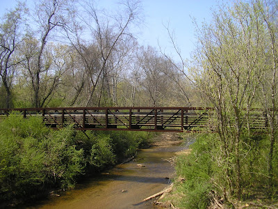
The next section contains the longest isolated stretch of the whole journey. After the last Polk County Trailhead at Coot’s Lake, you travel 11.5 between trailheads. The tradeoff for the isolation is you get the most scenic stretch of the entire trail. Coot’s lake is a pretty piece of water. About 2.6 miles East you cross through the 800 foot long Brushy Mountain Tunnel. Exiting the tunnel you pass through the Paulding Wildlife Management Area. We actually saw wild turkeys on the path, but other wildlife might be possible. You then cross the Pumpkinvine Creek Trestle , a 750 foot long railroad bridge, just west of the Rambo Trailhead. Both the Tunnel and the Trestle are worth the stop to look around, but we didn’t as we had miles to go, and had been there before. Rambo is a fairly amenity free parking location, but if you continue another two miles to Tara Drummond, there’s accessible restrooms and water.

By the time we reached Dallas, our group of four had significantly separated into two groups of two, so we skipped lunch because we were to far behind. From here to Smyrna the path gets progressively more crowded as you get closer and closer to the city. And this is the area where you see the most road crossings. The trade off for lack of serenity is the comfortable feeling that you are not too far from help, should it be necessary, and after 40 miles under your belt, this is good to know. You cross through Hiram, leave Polk County, and go through Powder Springs and Mableton. Once in Cobb County, there are some nice walking trails off the Comet, near Center Road (Wildhorse Creek) and Concord Road (Heritage Park). The road gets pretty straight and pretty crowded the rest of the way. At the Floyd Road trailhead, there’s a bike shop. When you get to mile marker Zero at Mavell Road you are not actually done, there is still a mile to go principally uphill to reach the Highland Station Parking lot.

For a trip of this magnitude, preparation is far more important than usual. The three chief concerns are water, food, and bike maintenance. Water is crucial. I read a post somewhere where they said that you should also bring a camera, so that when you run out of water you can sell it to get more water. I travelled with a 72 oz. camelback which I filled and drank three times, with only one bathroom break. Food is another important consideration, I calculated on a website that six hours of moderate riding for someone of my size would burn about two days worth of normal meals. I packed a case of Power Bars and ate all but two. Bike maintenance is a lesser worry, because the trail is clean and paved, but you should travel with essential repair tools including a flat tire repair kit, air pump, and bike wrenches, just in case, it would be awful to be stranded a long time in certain areas.

The 64 mile trek is not normally for the casual rider, like myself. It took me a little over 7 hours to complete with significant and well needed breaks. The faster two riders finished about an hour ahead of us. The beauty of the Silver Comet Trail is that you can bite off as much or as little as you want. Most people use the Cobb portion of the trail, probably due to its proximity. But the best portion is in Polk County. My recommendation for the more casual rider is that you put in at either Hiram, Polk Chamber of Commerce, or Rambo and head West to Rockmart. There you can eat lunch or whatever and then return back to your original spot. This way you get at 32-38 round mile trip hitting most of the highlights of the road, with a nice place to stop to break the work in two.
Bike Trail Essentials
Approximate Time: 6-8 hours (allowing breaks)
Approximate Distance: 64 miles
Trail Surface: Paved
Features: Small Georgia Towns, Rolling Countryside, Bridges, Trestles, Tunnels, Lakes, Rivers, Wildlife
Overall Rating: A
Scenic Quality: A
Athleticism: A+
Solitude: B
Value: A
Parking: Free (Various Locations)
Hours of Operation: Daylight Hours
Facilities: At many trailheads
Maps: Silver Comet Website, Trail Express, Google, and
Path Foundation
County: Polk, Paulding, & Cobb
 |
| From Silver Comet Trail |
The Granddaddy of all bicycle trails in Georgia is the Silver Comet Trail. Heck, it might be the Granddaddy of all bike trails in the US. It runs almost 64 miles from Smyrna to the Alabama State line, mostly on what was once the railroad track used by Seaboard Railroad’s Atlanta to Birmingham line. If you continue through Alabama on the Chief Ladiga Trail it will take you 96 miles, all the way to Anniston, Alabama. The road is paved, relatively flat (3% overall grade), and is completely off roads used by cars, except for a few crossings, and a very short patch in Western Polk County. So how does one write a good article about this unique attraction just 13 miles outside of Atlanta. Well, you probably have to ride the whole darned thing.
On Oct 2, 2010, The Urban Baboon and three close friends set out to do just that. The longest I had ever biked in one day up to that point was 32 miles. Our plan was to drive two vehicles out to the Highland Station parking lot in Smyrna, drop the smaller car there, cram the five of us (we needed a driver) and four bikes into the minivan and be dropped at Esom Hill, near the State line, and then have the driver go back to Highland Station and leave the van there for us when we finished. The beauty of this plan was its simplicity. The downside was there was no turning back.
At Esom Hill, there is a small parking lot close to the Alabama border. It is quiet and serene and there are no facilities there. The nearest place for any supplies or amenities is in Cedartown, about 7 miles away. In order to say that you rode the entire trail, you need to head west first about .3 miles to get to the archway that makes up what they call Stateline Gateway Park, not much of a park, but a fitting starting point for a day on two wheels.
The Polk County portion is the least travelled part of the trail. The 7 miles to Cedartown run by farms and fields. It is also the most hilly portion of the trail with a few noticeable inclines and descents. At Cedartown, there is a depot where supplies are available, though you are required to walk you bike in front of the store. The next stretch to is a bit more of the same, about 14 miles to downtown Rockmart. We used this as our first breakpoint. Rockmart has a nice little park and a fair number of businesses very near the trail that could be of use to the Trail Rider. We had originally planned to lunch here, but it was only about 10:30 am, so we took a short break and rescheduled lunch for Dallas. Rockmart is the lowest point on the trail, so the rest of the route is uphill, but fairly gentle, almost unnoticeable.
The next section contains the longest isolated stretch of the whole journey. After the last Polk County Trailhead at Coot’s Lake, you travel 11.5 between trailheads. The tradeoff for the isolation is you get the most scenic stretch of the entire trail. Coot’s lake is a pretty piece of water. About 2.6 miles East you cross through the 800 foot long Brushy Mountain Tunnel. Exiting the tunnel you pass through the Paulding Wildlife Management Area. We actually saw wild turkeys on the path, but other wildlife might be possible. You then cross the Pumpkinvine Creek Trestle , a 750 foot long railroad bridge, just west of the Rambo Trailhead. Both the Tunnel and the Trestle are worth the stop to look around, but we didn’t as we had miles to go, and had been there before. Rambo is a fairly amenity free parking location, but if you continue another two miles to Tara Drummond, there’s accessible restrooms and water.
By the time we reached Dallas, our group of four had significantly separated into two groups of two, so we skipped lunch because we were to far behind. From here to Smyrna the path gets progressively more crowded as you get closer and closer to the city. And this is the area where you see the most road crossings. The trade off for lack of serenity is the comfortable feeling that you are not too far from help, should it be necessary, and after 40 miles under your belt, this is good to know. You cross through Hiram, leave Polk County, and go through Powder Springs and Mableton. Once in Cobb County, there are some nice walking trails off the Comet, near Center Road (Wildhorse Creek) and Concord Road (Heritage Park). The road gets pretty straight and pretty crowded the rest of the way. At the Floyd Road trailhead, there’s a bike shop. When you get to mile marker Zero at Mavell Road you are not actually done, there is still a mile to go principally uphill to reach the Highland Station Parking lot.
For a trip of this magnitude, preparation is far more important than usual. The three chief concerns are water, food, and bike maintenance. Water is crucial. I read a post somewhere where they said that you should also bring a camera, so that when you run out of water you can sell it to get more water. I travelled with a 72 oz. camelback which I filled and drank three times, with only one bathroom break. Food is another important consideration, I calculated on a website that six hours of moderate riding for someone of my size would burn about two days worth of normal meals. I packed a case of Power Bars and ate all but two. Bike maintenance is a lesser worry, because the trail is clean and paved, but you should travel with essential repair tools including a flat tire repair kit, air pump, and bike wrenches, just in case, it would be awful to be stranded a long time in certain areas.
The 64 mile trek is not normally for the casual rider, like myself. It took me a little over 7 hours to complete with significant and well needed breaks. The faster two riders finished about an hour ahead of us. The beauty of the Silver Comet Trail is that you can bite off as much or as little as you want. Most people use the Cobb portion of the trail, probably due to its proximity. But the best portion is in Polk County. My recommendation for the more casual rider is that you put in at either Hiram, Polk Chamber of Commerce, or Rambo and head West to Rockmart. There you can eat lunch or whatever and then return back to your original spot. This way you get at 32-38 round mile trip hitting most of the highlights of the road, with a nice place to stop to break the work in two.
Bike Trail Essentials
Approximate Time: 6-8 hours (allowing breaks)
Approximate Distance: 64 miles
Trail Surface: Paved
Features: Small Georgia Towns, Rolling Countryside, Bridges, Trestles, Tunnels, Lakes, Rivers, Wildlife
Overall Rating: A
Scenic Quality: A
Athleticism: A+
Solitude: B
Value: A
Parking: Free (Various Locations)
Hours of Operation: Daylight Hours
Facilities: At many trailheads
Maps: Silver Comet Website, Trail Express, Google, and
Path Foundation
County: Polk, Paulding, & Cobb