Showing posts with label Indian History. Show all posts

The Falls on Warwoman Dell

Chasing Waterfalls 2010 Episode 3 Map
From Becky Branch Warwoman Dell

Heading North to the mountains earlier this year on a hot summers day, a day in which the combination of temperature and demands of life had made us a bit uninspired and lethargic, we decided to make a pit stop to see a waterfall in hopes that the experience might just recharge our internal batteries. We had targeted a site about three miles off Hwy 23 about 2 hours outside of Atlanta on our way to Dillard, Georgia. The place we visited is part of the Warwoman Dell Recreation Area, which has its own small waterfall.


The hike was short, but that’s what we wanted. From parking lot to the falls is an easy walk of about .4 miles. It’s easy but not simple as there is an elevation change of about 300 feet over the course of the trip. We you get to the end, you can’t help by being taken in by the falls, which can best be described as cute. It’s a small 20 foot cascade placed in a little rock nook in the Warwoman Dell Wildnerness. It is a very intimate and pastoral setting. You can literally stand under it in a pool of water not 10 inches deep. The coziness and the tactile possibilities of these falls made this visit very enjoyable.


You can extend the hike by walking the nearby Warwoman Dell Nature Trail that begins on the West side of the parking lot. It takes you in a loop about .4 miles through some pretty trees and has plenty of signs describing and identifying the local flora and fauna. As Warwoman Dell is actually on the Bartram Trail, you could extend your outing by continuing onward to Martin Creek Falls, which lie about .5 miles up the Bartram trail on the West side of the creek. The falls also sit about 12 miles up the trail from the previously posted about Dicks Creek Falls.


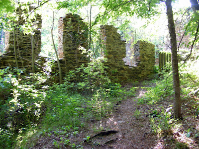
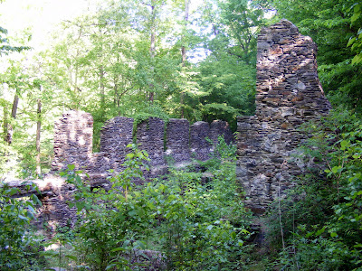
Along the Trail, you will walk very close to a Spring house, where it almost seems like your trespassing through their backyard, but rest assured it is the public trail. There is also the beginnings of a railroad that was never finished, which was intended to connect Atlanta to Midwest markets in places like Cincinnati. The work was cut short by the outbreak of the Civil War. What remains are basically rock steps and a flat bed path, which is what I suggest for you walk back from the falls to complete a .8 mile loop. There is also the Indian History of the Warwoman herself, who was said to have lived in the Area. There is some debate over whom the Warwoman is, being either Nancy Hart of Revolutionary war fame or as the signs on the trail suggest some one of Indian Descent, possibly Nancy Ward (Indian Name Nanye-hi). Or some suggest another unknown Cherokee woman of some stature.


I truly enjoyed my half an hour at the falls and hour on the trails. That being said, I would think this spot would be best enjoyed as part of a serious of short outings in the area, as we did that day. My experience is that my time on or near the Bartram Trail is among the most pleasant , beautiful, and serene of all my jaunts. The Warwoman Dell area is certainly no exception.


Trail Essentials
Approximate Time: 1 hour
Approximate Distance: .8-1.2 miles
Features: Waterfalls, Nature, Railroad Ruins

Overall Rating: B+

Scenic Quality: A-
Athleticism: C
Solitude: A
Value: A
Parking: Free
Hours of Operation: Daylight Hours
Facilities: Outhouse at Trailhead
Maps: Green Blazes, In this Google Book
County: Rabun County


Oconee Indian Mounds

They can’t all be winners, kid Map
From Oconee Indian Mounds

Now I posted a while back about the really cool ruins at Scull Shoals. In that post, I mentioned that one book I read said there were Indian Mounds not too far from there, but I didn’t go. I went back last year with the sole purpose of finding those mounds and I did. People have asked me how every place I go I seem so excited about. The answer to that question is that if I go somewhere and its underwhelming, I tend to shelve the story. But in response to an email, I bring you the story of the Oconee Indian Mounds Trail (here or here)


These photos were taken in April of 2009, after I went with a different friend and his dog to see Skull Shoals. The ruins there were just as nice the second and third times. It was early enough in the day and my companion was game so I sought out this trail a short distance away. To get there, take the road that was the last chance to turn right headed to Scull Shoals, drive a short distance, take the next left, and go to the end. Trust me it’s not far, I met a man who ran between the two sites as exercise.


The trail itself is only one mile long and flat. Just like anything else in the Oconee floodplain, it has a good chance to be muddy, swampy, and murky, as was the case on our jaunt. When you get to the end you will see signs denoting the historical significance of the area and not to disturb the artifacts. The mounds themselves are difficult to see being covered by trees and at the edge of a pretty swampy area. If you were expecting a mound site akin to Ocmulgee or Etowah, that won’t be the case. There is no doubt of its archeological importance, being two good size Lamar Indian Mounds, but its visual significance is minimal. The picture above is one of the mounds.  But that’s ok, not everything has to be a monumental attraction. The best part of the trip was that a total stranger we met on the trail offered us a beer, I told him I would write about him but I didn’t get around to it until now. I think his name was Jim, and I am sure he worked in some nearby factory in the HR department, so here’s my public thanks (He said he read my site—email me if your him and describe the dog so I will know its you).  It was the second time in two weeks that had happened.


So if you are looking for a tidy little add-on to your Scull Shoals day, this place works. Or if you are the type who wants to soak in every piece of Indian Heritage you can find, you should put the Oconee Indian Mounds Trail on your list. And if you are an actual archeologist, I bet this is stupendous. But if you are looking for great photos, Scull Shoals will probably dwarf this site in your mind.


Trail Essentials
Approximate Time: 30-45 minutes
Approximate Distance: 1 mile
Features: Indian Mounds
Overall Rating: B-

Scenic Quality: C+
Athleticism: C-
Solitude: A-
Value: B
Parking: Free
Hours of Operation: Daylight hours
Facilities: None
Maps: None
County: Greene County
Blue Ridge Scenic Railway

He’s goin’ back to a simpler place and time…Map
From Blue Ridge Scenic Railway


There’s something in our collective unconscious that thinks trains are romantic. As a person who has actually travelled by train, I understand this in part, but I know it’s mostly being stuck in a cramped box for hours. But still even I tend to romanticize the railroads. Now there are some great things about it, the slow passage of time, views of the American countryside, and the lullaby of rail on steel. A great way to get the best of the rail without the worst of the rail resides about an hour and 45 minutes north of us in Blue Ridge, Georgia at the appropriately named Blue Ridge Scenic Railway.


Leaving the city of Blue Ridge every day except most Tuesdays and Wednesdays (Schedule) is a seven or eight car train that traverses the Murphy Connector between Blue Ridge and McCaysville, Tennessee. The trip is 13 miles one way with an hour break in McCaysville. There are normally two or three open air cars and two or three closed cars so you can escape or enjoy the weather. The cars themselves are restored historic railcars from times past and places as far away as New York City. The trip takes about four hours in total. There are restrooms and a snack car on the train if either should become necessary.


The Summer cost is a little on the high side at $32 (fares) with discounted pricing for Seniors and children 12 and under. But compared to buses, trains, and planes, it’s not that out of line. And what you’re paying for is the experience. You get to rush behind peoples homes and along the serene Toccoa River. Along the way, people run out to wave at the passing trains, you get to see an ancient Indian fish trap, and the occasional encounter with wildlife. This must be a fascinating way to see the fall colors turn, if that’s your sort of thing.


The only negative about the trip is the stop in McCaysville. Sure it’s a cute little country town, and it has this charming blue stripe running through it separating Georgia from Tennessee and the town of McCaysville from Copperhill. But If you’re thinking of dinner, the food is a bit regrettable. We ate at the Nifty Fifties Diner, which had a beautiful view of the river and some nice bluegrass music, but the food was reminiscent of the kind of stuff you’d get at your average bowling alley, but kids may enjoy it. Based on my discussions with fellow travellers, I think your best bets would be the BBQ joint across from the train station (not next to it) or the Mexican eatery.


I write this because I recently received an email about discounts to the rail road for weekday excursions and for reserving the Christmas ride with Santa Claus, if you book before August 31st. The code for the Santa excursion is SUMSANTA10 and the weekday trips is SUM10WEEKDAY, both being good for 10% off (2010 codes). Even at full price, the Blue Ridge Scenic Railway is an enjoyable was to relive the glory days of American Trains without the commitment or hassle of spending too much time stuck in a metal box.

Sawnee Mountain

CHIEF SAWNEE’S SPIRIT LIVES HERE map
Chief Sawnee
From Sawnee Mountain


Now when I used to talk about the great nearby mountains, everyone knew I was speaking about Kennesaw Mountain and Stone Mountain : the (fraternal) twin sisters residing in Cobb and DeKalb County respectively. Both were about 1600-1700 feet in height and both had their separate but distinct charm. And I thought that was all you or I were going to get, at least until you got up to the Appalachians But I recently discovered I was wrong. Forsyth County has recently (2005) thrown their hat in the mix and opened up a new nature preserve surrounding a comparable mountain just outside of Cumming, Georgia by the name of Sawnee Mountain .
Indian Seat Trail
Sawnee Mountain looms over Cumming at a respectable 1963 feet. It is the mountain that you see when you pass Exit 17 on 400 with the satellite tower on it. And at only about 45 miles outside of Atlanta it serves as another option for those looking to get away from it all without going to far.
View from the Indian Seats
From Sawnee Mountain
The path is impeccably cleared and the footing is fantastic. The current trails run about 3.1 miles and can be covered in 2.5 to 3 hours. There are preparations being made to enhance the hiking here to over ten miles of trails. At that time, I believe this will be a significant destination for people with similar hobbies as mine. Now considering the height of the mountain, you might expect a difficult climb, but it really isn’t that difficult. Unfortunately, my GPS tracker failed and I can’t tell you the elevation gain, but based on experience, I would place this as a bit less intense that Kennesaw or Stone Mountain, even with the higher elevation (I would approximate a gain of about 450 feet). The trail guide indicates that the Indian Seats Trail to the summit is Easy to Moderate, though I would call it a solid Moderate for the casual hiker.
Atop Sawnee Mountain
Sawnee was apparently a well respected Cherokee Indian Chief. There are some rocks called “Indian Seats” that apparently he and the tribal leaders would sit in, surveying their people and land below. I don’t know much about him other than this cool story on Moonlit Road of him burying Indian Gold deep within the mountain and his restless spirit protecting it.
The truth is that there are two accessible gold mine shafts that you pass along your walk. But there were not protected by an Indian Spirit but rather by iron gates and padlocks. Nonetheless, they were an interesting diversion on the path.
Ga. Mountains in the distance
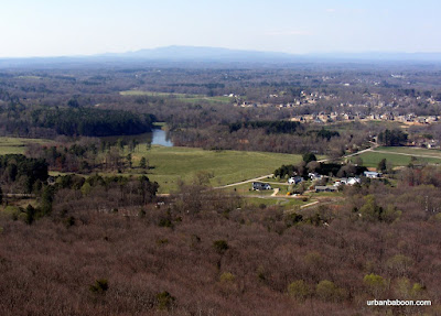
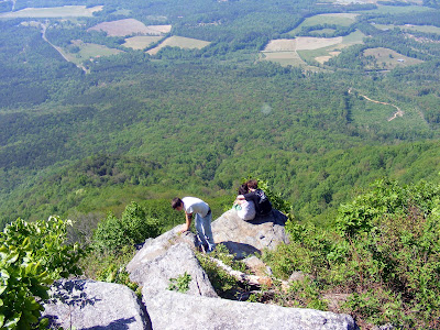
But the main attractions is the view from the top of the mountain. You can sit at the Indian seats or stand at a nearby observation deck to get a marvelous view of the low lying countryside against a backdrop of grand Georgia Mountains in the distance. The vista spans from Pine Log Mountain to the West to Brasstown Bald in the North East. It’s a view that is definitely worth hauling yourself up the mountain.
Abandoned Gold Mine Shaft
From Sawnee Mountain
The park looks to have all the other amenities too. They have a nice visitors center complete with information and comfy rocking chairs. Another part on the path has a tree house to keep the young ones entertained. And perhaps, most curiously, they have these tree top platforms that you can sign up to climb into (under supervision, of course) on the first and third Saturdays of every month.
Inside the Gold Mine
The Sawnee Mountain Preserve is enchanting and seems to be one of the more well thought out nature centers I have encountered. I think its overlooked at this point because of its relative newness, but given time, I believe it will be spoken of as the third great nearby Atlanta Mountain.
Tree Climbing Platform

Trail Essentials
Approximate Time: 2.5 to 3 hours
Approximate Distance: 3.2 miles
Trail Surface: Principally compact soil, small patches of rock footing
Features: Mountain view, views of Mountains, Abandoned Gold Mines.
Overall Rating: A-
Scenic Quality: A-
Athleticism: A-
Solitude: A-
Value: A
Parking: Free
Hours of Operation: Dawn to Dusk, Closed Major Holidays, Visitor Center has shorter hours
Facilities: At Visitor Center, also at secondary parking lot
Maps: At Visitor Center, here
County: Forsyth.

Rock Eagle Effigy Mound

Eatonton’s Enigmatic Eagle map

The Bird's Head
From Rock Eagle Ef...


One aspect of our Georgia History I find fascinating is the Indian Culture that once resided here. An intriguing aspect of that is the penchant for the local Native Americans to build perplexing structures. We’ve seen the mounds they built at Etowah (there are others). We’ve seen rock structures like the one at Fort Mountain . But I think the most curious of the bunch is the Rock Eagle Effigy Mound located outside of Eatonton, Georgia, a little over an hour East of Atlanta.

Bird in Entirety

While its relatively easy to understand why a towering mound or a rock wall would serve a purpose as either a town centerpiece or a defense structure, the Eagle Effigy is more ornamental, its significance is more in its actual design. Which begs the questions: why a huge bird? And why here? And why do they insist on calling it an eagle when it seems to be more like a buzzard or vulture? The local, modern-day Indians offer that it was some sort of ceremonial center, which I will defer to their expertise, but the unanswered questions leave this place more enigmatic, more romantic, and greater fuel for our imaginations.

the Height of Rocks at the Breast

In a 1950’s archeological excavation of the site by A. R. Kelly with the backing of the University of Georgia, a single set of cremated remains was found (along with a single arrowhead, though the more accurate term projectile point is used in the literature) inside the breast of the creature. Despite this finding, its is not considered to be an Indian Burial Ground, but we know for sure someone was once buried here.

Tower in Background

The bird measures 120 feet in wingspan, and 102 feet from head to tail. The quartz stones are piled some 8 feet high at its highest point at the breast, but at the extremities of the bird are much smaller rising no more than a couple of feet. There is evidence of non-indigenous rocks being part of the mound, which may explain the eye of the eagle which has a reddish coloration. Because of the size of this Indian Artifact, a 3-story tower was built to make viewing its entirety easier (I found this video of someone climbing the tower, if you‘d like to see).

Closer view of Rocks at neck and head

The site is currently controlled by the University of Georgia as a 4-H Center. Though parking and the tower are free, they have some programs there that charge fees. If you stay for a while, you might see some interesting native wildlife, like doves, owls, and maybe a tortoise.

peering out the base of the tower

As I’ve always said there is much more to our history than the Civil War and the local Indian Culture here is captivating. The Rock Eagle Effigy Mound is one of the more beguiling sites and one of the more memorable ones I have seen. It’s certainly worth a side trip if you find yourself in the Eatonton Area.

CNWR-Sope Creek

Marietta Paper Mill Ruins & More map

Mill Ruins on the Creek
From Sope Creek


One of the more compelling places among the Chattahoochee River National Wildlife Reserve is the Sope Creek Unit . It may be overlooked to a degree because it does not run along the Chattahoochee River at all. Sope Creek is a small but pretty creek that feeds the river.

Sope Creek

This one is arguably my favorite of all the CNWR units. Even with its proximity it is relatively peaceful and uncrowded. The trails are of varying inclinations to get the heart pumping but nothing overly strenuous. The outer loop runs about 3 miles, but there are several crossing paths that can take you an additional 3 miles easy, and you can follow the river a bit longer than that if you want.

Marietta Paper Mill Ruins

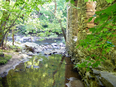
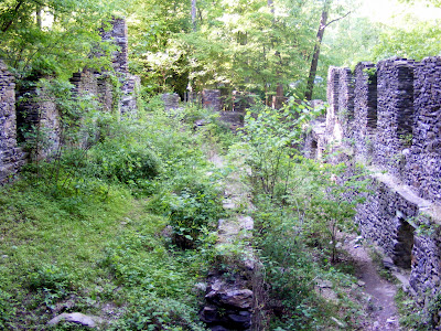
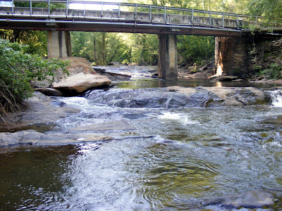
But what I like most about it is the interesting things to see. The centerpiece of the park is the Marietta Paper Mill Ruins . The Mill, built in 1859, was a primary source of paper for the South and rumored to be place Confederate Money was printed (this is unsubstantiated). Garrard‘s Soldiers burnt the mill down on July 5, 1864. It was rebuilt a year later, but suffered serious fire damage again in 1870. Again being rebuilt but closed for good in 1902. The area in its heyday held the paper mill, a flour mill, a twine plant, and a power plant. The ruins are in reasonably good condition, especially compared to other ruins I have seen like Roswell Mill or Skull Shoals. And very pretty covered in plant growth along the rocky creek. Some of the ruins are on the West Side of the Creek, but the larger portion are on the Eastern side, you have to either cross the vehicle bridge or wade across Sope Creek to get to the other side to see the additional pieces

More Ruins

It also has an Indian ties being the residence of an Cherokee man named Sope, for which the creek is purportedly named. Somehow, due to his stature in the community he was allowed to bypass the Cherokee Removal and remain on his land. He is said to be buried in Sewell’s Cemetery.

More Ruins

There’s also a covered bridge story here. Cobb County’s second to last covered bridge crossed the road right at the vehicle bridge, but it was burned to the ground in 1964 (Arson Suspected). Only the masonry at the base remains. One can only imagine how much prettier this already beautiful location would have been it the Paper Mill Covered Bridge still survived.

Paper Mill Covered Bridge Masonry

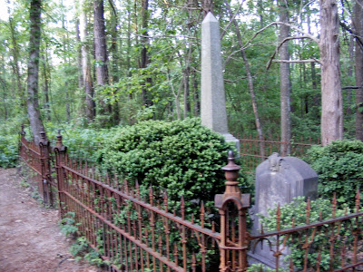
Also if you walk the eastern path away from the ruins toward the Columns Drive parking, you will literally stumble across a small cemetery with three tombstones. The gates are artistically rusted and it appears to be the family of Daniel Scribner M.D. Dr. Scribner died in 1883 and the other two are seriously worn such that I would only be guessing what the names are. (If you know more about this please let me know).

a note on the cemetery after original publication: According to this website here is some additional information about the gravesite, posted by a Charles Andrews in 2004:

Dr. Daniel Dana Scribner married Sarah Jane Ansley, daughter of Marlin and Zeruah Johnston Ansley. Sarah is buried there with her husband, four Scribner children, and my GGG grandmother Mary Winifred Ansley Andrews. Mary Andrews was Sarah's sister. They, both widows, lived together on the Scribner place in their later years until their deaths in the 1880s.
I have Dr. Scribner's medical diploma from the University of Pennsylvania Medical College.
Dr. Scribner's Grave

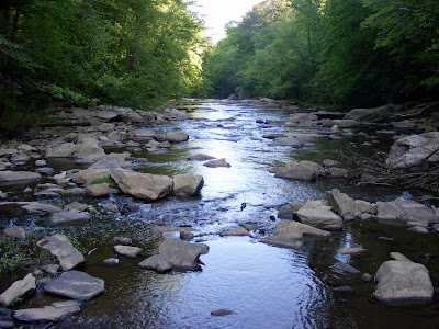
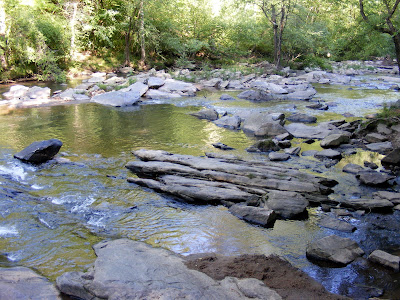
The Creek itself has very pleasant cascades and there a small pond on the West side of the park, both apparently good fishing locations. So if you are looking for a pretty place with relative quiet that anyone can enjoy for a few hours, the Sope Creek Unit is great answer.

Sope Creek Again


Trail Essentials
Approximate Time: 3-4 hours
Approximate Distance: 4-7 miles
Trail Surface: Compact Soil, a short patch on paved road with traffic
Features: Creek, Cascades, Ruins, History

Overall Rating:B+
Scenic Quality: A
Athleticism: B-
Solitude: B
Value: A
Parking: $3
Hours of Operation: daylight hours
Facilities: at the parking area
Maps: Trail Map
County: Cobb

Blood Mountain

GOOD MOUNTAIN, BAD REPUTATION MAP

View from the top
From Blood Mountain

One of the most exhilarating hikes I’ve been on here in Georgia is climbing the Blood Mountain Peak along the Slaughter Creek Trail. It traverses some dense sections of the Blood Mountain Wilderness and reaches the highest point on the Appalachian Trail at 4,458 feet (Map of Peak). I think the Elevation of Lake Winfield Scott is about 1740 feet, so its like going up Stone Mountain a little over four times.

Lake Winfield Scott

Unfortunately, there has been a recent tragedy to a fellow hiker in the shadow of the Mountain. The news reports reverberate with the sad ending of the life of Meredith Emerson, unknown to me until the news broke, but a fellow traveler for sure.

In honor of her spirit there will be a memorial hike at the nearby Mountain Crossing (info here). Be there if you can.

“Pretty Tree on the Slaughter Creek Trail

The events that transpired should heighten in all of our minds the needs for preparation and protection. I’ve been known to hike alone, but I’m an unattractive 6’3” 240 pound man with an ornery disposition. Please go in a group, just for the sake of potential injuries, Hiking is a mostly safe pastime. Most of the people you meet are true salt of the earth folks (read this post, it‘s true I was there). If you need to go alone, choose a heavily monitored area like Kennesaw or Stone Mountain.

Blood Mountain Peak View

Blood Mountain shouldn’t be remembered as a Mountain of Blood. The Blood moniker stems from an old Indian Battle between the Creek and the Cherokee (the Cherokee won), but still nothing could sound more menacing than taking the Slaughter Creek Trail up Blood Mountain. Don’t worry the Battle ended over a century ago.

Slaughter Creek Path

What you get is peaceful wilderness time. You get your heart pumping blood through your veins. You get awe inspiring mountain views. You might get to see a deer or a bear or an owl. You might meet some other folk on the trail. You will get a sense of accomplishment if you scale the 6th tallest mountain in Georgia.

CCC built Cabin

At the top, there are two man made structures of note. There is the CCC constructed cabin which you can hole up in if the weather runs afoul. There’s actually a little sign-in booklet to let future travelers know you were there. On or about the 6th of June, 2007, you will see what I consider the first advertisement of urbanbaboon.com in its pages. You can stand on a big rock mound next to the cabin to get the big picture view of the North Georgia Mountains. Just to the West of the Cabin, there is an outhouse, which may be the most disgusting outhouse in the world. It is the most disgusting, I’ve ever seen. It made a fellow hiker remark, “I’d rather just [bleep] in the woods.” And he was right.

Me and my Brother made it up the mountain in a little over two hours. It’s better than 5 miles one way, and this is generally considered the easiest access point to the peak. I know I told you to be prepared but my brother made it up to the top of the mountain with only a single bottle of water and a pack of Starburst. Not the best plan, but its now become a tradition.

Trail Essentials
Approximate Time: 4-5 hours
Approximate Distance: 5 miles one way (10 round trip)
Trail Surface: Compact Soil, Stairs
Features: Wilderness, Athletic Sections, Mountain Views, Rustic Cabin
Scenic Quality: B+
Athleticism: A
Solitude: B
Value: A
Overall Rating: A-

Parking: $5 (June 2007)
Hours of Operation: Open Year Round, Sunlight Hours
Facilities: At the recreation center and the top of the mountain (yuck)
Maps: None, prepare ahead of time (look here)
County: Union

Fort Mountain

MYSTERIOUS MOUNTAIN FORTRESS MAP
“Mysterious
From Fort Mountain
In the middle of Summer, I ventured out with friends to see something that I read about that really intrigued me. In a park with over 14 miles of hiking trails, just outside of Chatsworth, there is a 855 foot long rock wall, which is of disputed origin. In case you didn‘t know, I am talking about Fort Mountain State Park.
“Rocks,
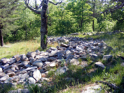
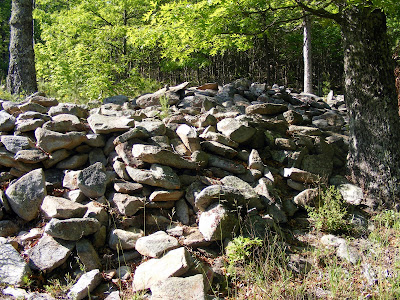
The Strange Rock Wall Formation presents itself like a fortress, thus the name Fort Mountain. Actually, it looks more like the rubble of a demolished wall, zigzagging its way stone upon stone with dimensions of about 6 feet in width and a height of no more than four feet in most places. It still is interesting to behold, but is more reminiscent of the rock formations like Eatonton’s Rock Eagle or its nearby Rock Hawk, than what I think a stone fortress might look like.
“Indian
The story of the wall is many fold. One story has the wall being built by Hernando De Soto and his band of Conquistadores as protection against the fearless Cherokees. This is widely held not to be true but is a nice legend. The most interesting story has the wall being built by white “moon-eyed” Europeans, under the lost Prince Medoc after sailing from Wales to what is now Mobile, Alabama, and then working their way inland. Again the purpose would be defense against Indians. Unimaginative geologists think that it might be the result of natural weathering of a generally horizontal stratum of a hard caprock of quartzites and conglomerates, but that’s no fun. There’s even a story that it was a Cherokee Honeymoon spot, due to the circular “love nests” that appears in places along the wall.

Most likely, it was the work of Woodland Indian Rockbuilders, but definitive proof doesn’t exist. But the rocks stir the mind to wandering. Wouldn’t it be fascinating if the Welsh were actually here in the Fifth Century. Welsh history has a similarly named lost sailing Prince, which makes that rendition possible, if not probable.
“View
You can drive through the park very near the rock structure, just to see the mysterious wall and the views, and your hike would entail a circle with two bisecting paths, putting your distance on the light side of two miles. It’s not very difficult, as most of the elevation would be born by the vehicle of your choice. There are several other hiking trails, including the longer backcountry Gahuti Trail, if your looking for more of a challenge.
“Tower
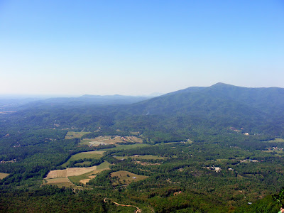
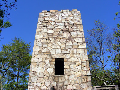
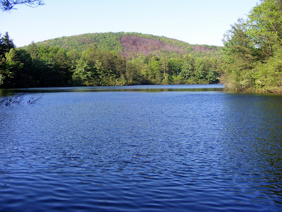
Also near the top is a tower built by the Civilian Conservation Corps in the 1930’s, a small cascading waterfall is found along the Goldmine Creek Trail, and a nice views of Fort Mountain Lake along the Lake Loop Trail (we saw a number of folks fishing there, if that’s your cup of tea). But the High Points are the Rock Wall and the tremendous views from the overlooks.

I was told you could hear mining at times on the mountain, but we went on a weekend so that wasn’t our experience. The mountain is apparently one of Georgia greatest deposits of Talc. It’s interesting how natural beauty and commercial interests can live side by side here.

At less that two hours outside Atlanta, with its natural beauty with perplexing mystery, Fort Mountain is a terrific spot to spend the day.

ShareThis

Related Posts Plugin for WordPress, Blogger...