 |
| From Cloudland Canyon State Park |
About as far away as you can get without leaving Georgia sits a tremendously scenic state park, which I’ve been told rivals anything you have seen in the state. Because of its relatively remote location, it remains quite pristine and reasonably quiet. But the talk of the area is almost deafening. Located on the Western edge of Lookout Mountain about 2.5 hours Northwest of Atlanta stands what has been called the "Crown Jewel" of the Georgia State Park system: Cloudland Canyon State Park.

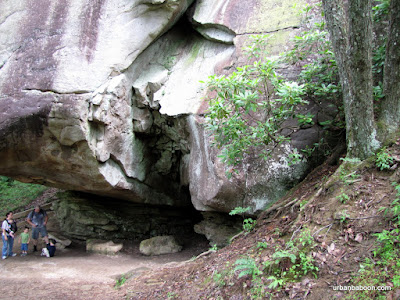
The area was designated as a State Park in 1938 after large donations of land from private owners. The years have seen the park grow in size from 1924 acres to its present 3485. Prior to state ownership, it was known as Sitton‘s Gulch , and the prominent feature of the park is the Gulch or Canyon that serves as the centerpiece of the park. There are several areas along the ridgeline that provide majestic views of various nearby mountains and you can see well into Alabama. The gorge was carved out by Sitton’s Gulch Creek over centuries at the confluence of Daniels Creek and Bear Creek. This makes for some very pretty rock formations, both along the canyon’s walls and deposits along the canyon floor.

In addition to the scenic vistas, there are two serene waterfalls at the base of the gorge on Daniels Creek. They are very cleverly named Waterfall One and Waterfall Two, falling 85 and 60 feet respectively. To be honest the waterfalls are really a series of cascades and there are numerous other opportunities to see and hear the pleasant song of tumbling water along the way.

There are five separate hiking trails at the park. On the day we went, we hiked the 5 mile West Rim Loop trail and the 2 mile Waterfall trail. The water fall trail climbs about 1200 feet in and out of the canyon through a series of switchbacks enhanced with well over 600 stairs. The easier of the two falls (and prettier) takes you .1 miles down to Waterfall One. To get to Waterfall Two, you must climb part of the way out and then down .3 miles to its location. Although the water itself may be a little less impressive, the second waterfall area is much more majestic and littered with fallen rocks. The West Rim Trail takes you along the ridgeline for the full view of the gulch and the areas beyond. There is a second shorter overlook trail, a 6.5 mile trail deeper into the canyon known as Sitton’s Gulch Trail, and another backcountry trail taking you to more remote camping sites.

When something is built up as the best thing you ever saw, its very hard for the location to live up to that reputation. We have seen some amazing sights in Georgia from Amicalola Falls to the Cumberland Seashore to Providence Canyon . And I’ve never been to Stephen Foster State Park in the middle of the Okefenokee Swamp, which I’m sure is amazing. I don’t think that this is the absolute best thing the Georgia Parks system has to offer, but its clearly on the short list. But if you are looking for an affordable getaway filled with natural splendor, peace and quiet, and a solid physical challenge, this park delivers. The West Rim Loop and Waterfall trail combo is definitely one of the best hiking experiences I have had in Georgia, or anywhere for that matter.

FOR HIKING BLOGS
Trail Essentials
Approximate Time: 4 hours
Approximate Distance: 7 miles (5 mi West Ridge Trail, 2mi Waterfall trail)
Trail Surface: Rocks, Compact Soil, Stairs
Features: Great Vista & Mountain Views, Rock formations, Waterfalls
Overall Rating:
Scenic Quality: A
Athleticism: A
Solitude: A
Value: A-
Parking: Standard Ga State Park Fee ($5, June 2010)
Hours of Operation: 7am-10pm
Facilities: None on Trail, at Visitor Center, throughout park
Maps: at Visitor Center, online here
County: Dade County
A great place to camp and hike, it seems like it takes forever to get there but is worth it! I blogged about it here. Have a great weekend!
ReplyDelete